Germasogeia Dam to Kyparissia Circular Walk
Date Last Walked: November 2024
Distance: About 8 miles (13 kms)
Duration: Approximately 3 hours 30 minutes (excluding stops)
Difficulty: Quite hard walking: ascent and descent of 600 metres
GPX file available on request
The starting point for this walk is close to Limassol so this is a good one to do if you are staying there, particularly if you are reliant on buses or taxis. The Sunflower guide has a version of this walk but a number of the original signs and landmarks have now altered or disappeared, so the photos below may help.
This is also a good ‘achievement’ walk. It offers the opportunity to climb from just above sea level to almost 2,500 feet in a comparatively short space of time and without any specialist skills. Some stamina is required but nothing beyond the experience of an average walker. You will scale a small peak above pine forests and see some great views across the island down to the southern coast.
There are plenty of small birds to be seen in this area. The mixed vegetation, water and nearby houses make a great habitat for small birds and even in November we have seen coal tits, goldfinches, blackcaps, willow and Sardinian warblers amongst others. Higher up on the walk there are plenty of kestrels and partridges around. We’ve also seen buzzards soaring near the escarpment above Germasogeia Dam.
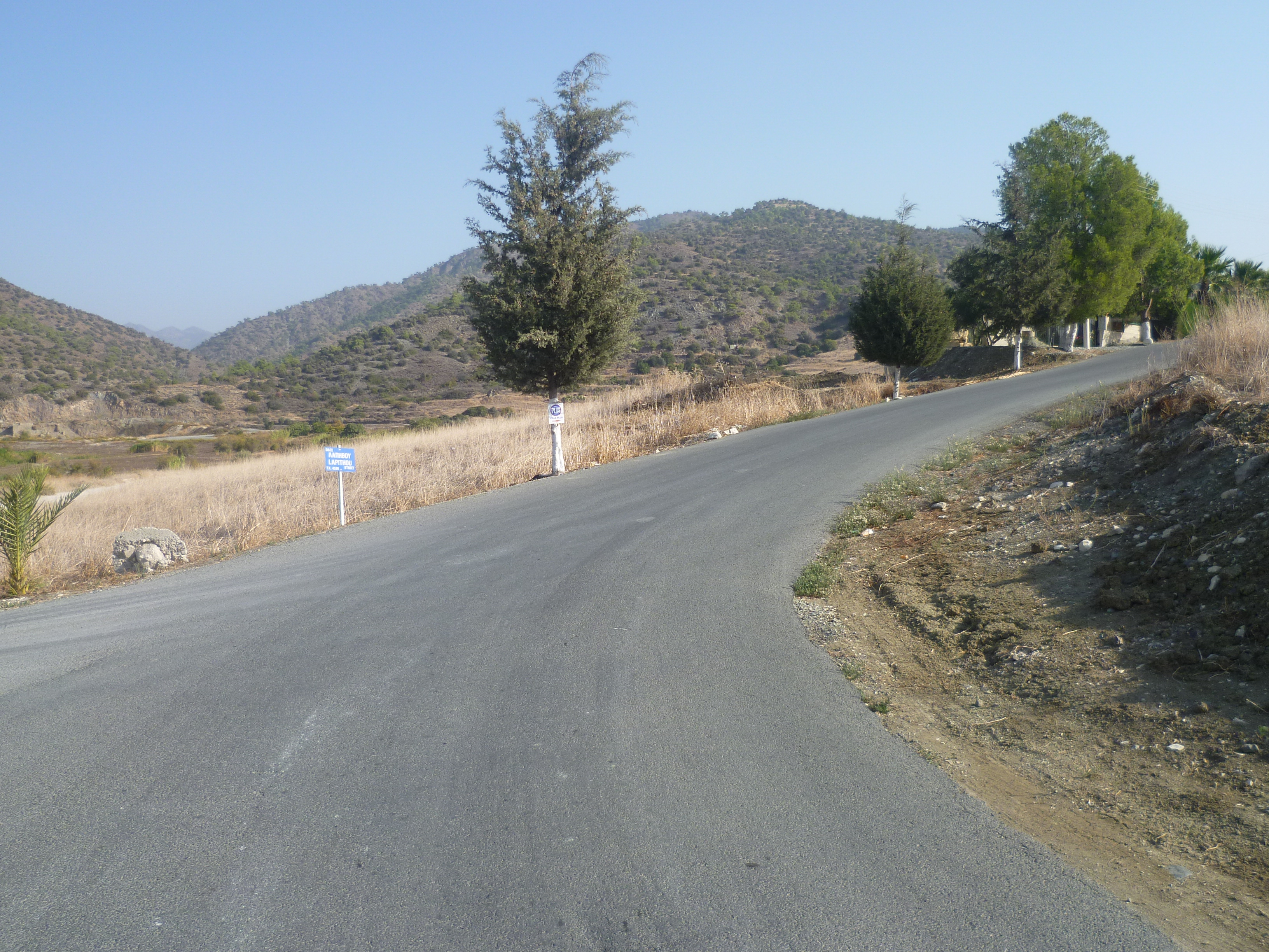
Drive toward Foinikaria on the F128 from Germasogeia, crossing over the dam and following the signs to the Germasogeia Nature Trail. As you enter Foinikaria you will turn off to the left, following a small road which skirts around the very edge of the reservoir until you come to a small, newly-refurbished car park on your left as the road itself bends upwards and round to the right.

This is the start of a nature trail: there used to be a trail board here, but it has long since disappeared. The GPS co-ordinates for this starting point are: 34.756442N, 33.096182E.
From the car park, set off on the tarmac road opposite (Lapithou Street) up the hill. You are currently at an altitude of around 70 metres above sea level.
You will pass Karava Street on your right and after 10-12 minutes reach a junction. [GPS: 34.759889N, 33.104280E] Take the left fork here (up a marked cul de sac) and walk up Kyparissovonou Street.

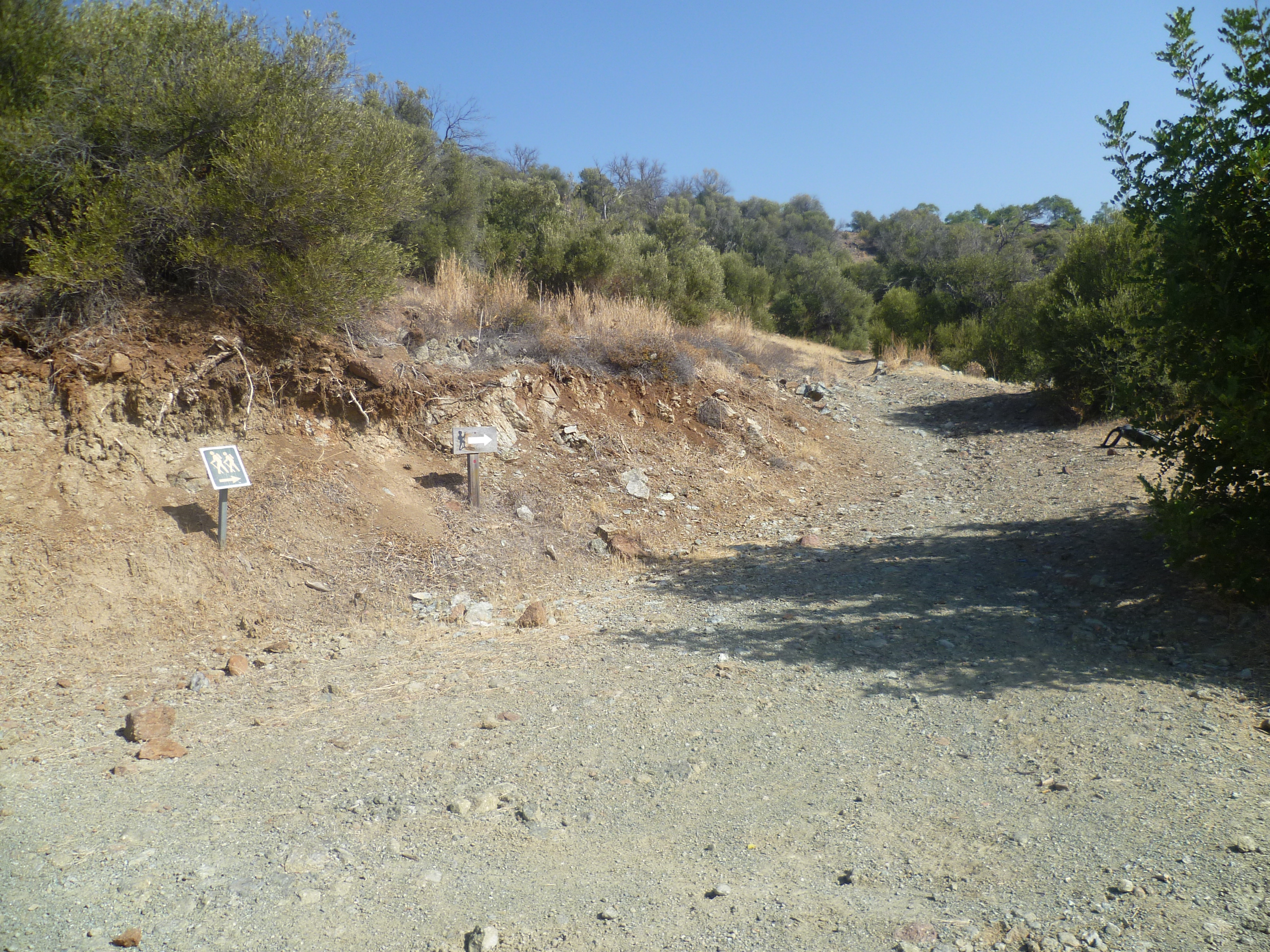
Continue along the asphalt road. At around 15-20 minutes you will be walking uphill between two chain link fences. As you reach the end of these fences the asphalt road turns to the right. Leave the road at this point and join a concreted track leading up the hill on your left. [GPS: 34.761827N, 33.106982E] There is (currently!) a trail sign directing you up the hill.
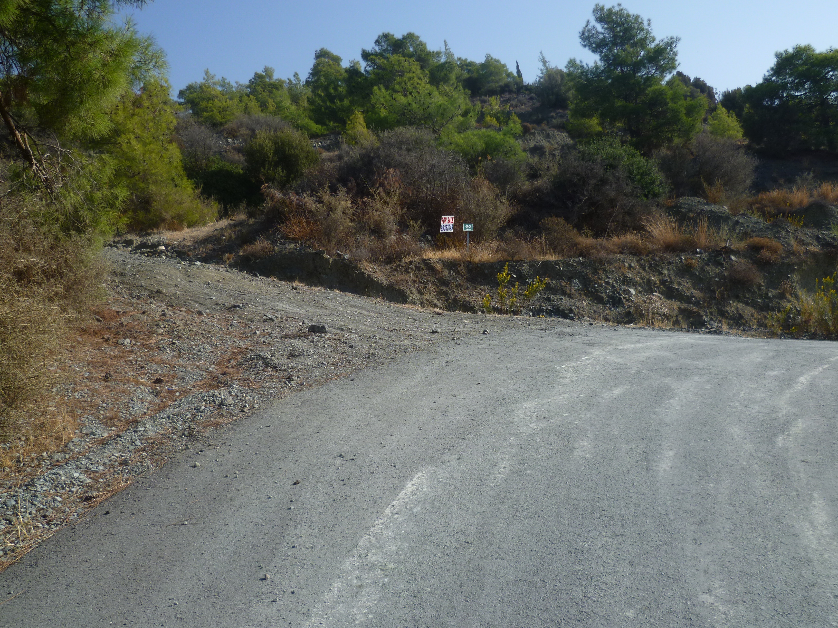
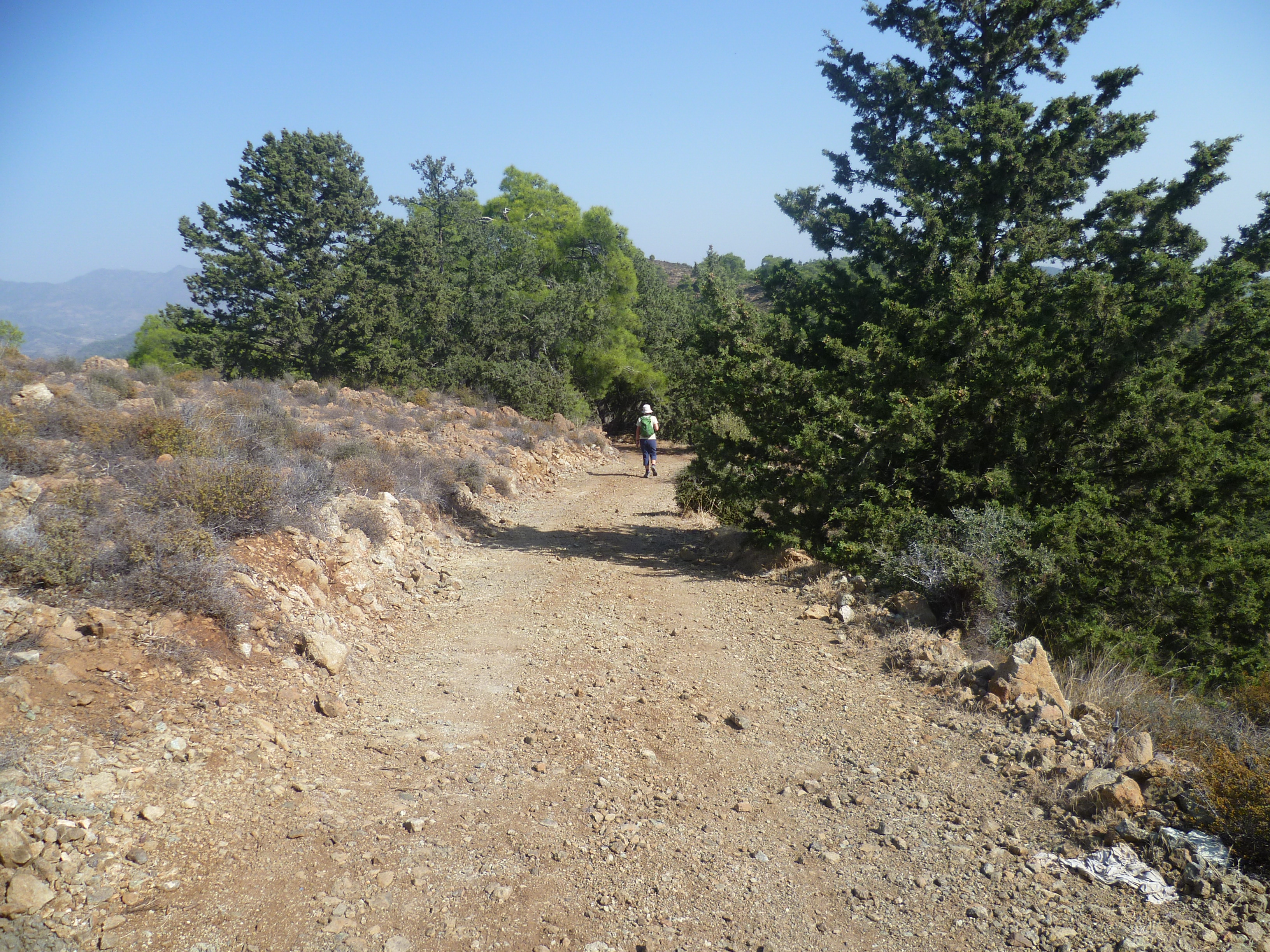
Follow this track as it climbs alongside a chain link fence to your left and begins rising, quite steeply at times. Stay on the main track – which soon deteriorates to an earth track – and ignore any turns off to the right or left. Essentially, you need to keep heading steeply uphill as indicated in the photos below…


…which were taken approximately two minutes and four minutes after leaving the asphalt road.
You will soon (at around 30 minutes) reach a T-junction with a dilapidated wooden hiking sign pointing to your route on the left. [GPS: 34.764653N, 33.109467E] The signs had, rather unhelpfully, collapsed in November 2024 but the photo below should enable you to clearly identify the junction.
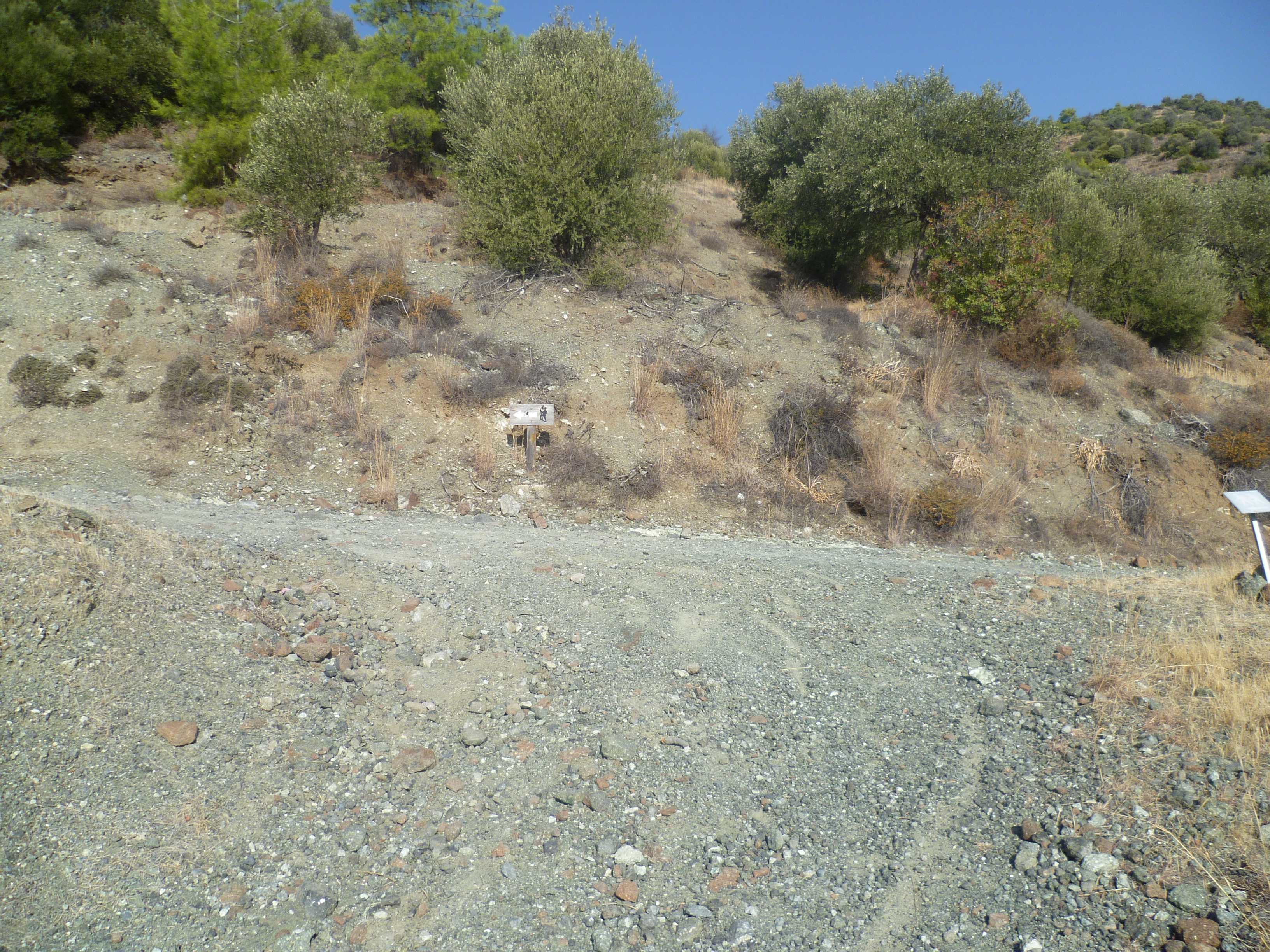
Keep following the trail, it can be a bit of a slog and quite steep in places, but worth it for the amazing quiet and the stunning views. At about 45-50 minutes you will reach two small (and increasingly faded) boards with arrows directing you off the track and onto a path to the right which continues to climb steadily up the mountainside.
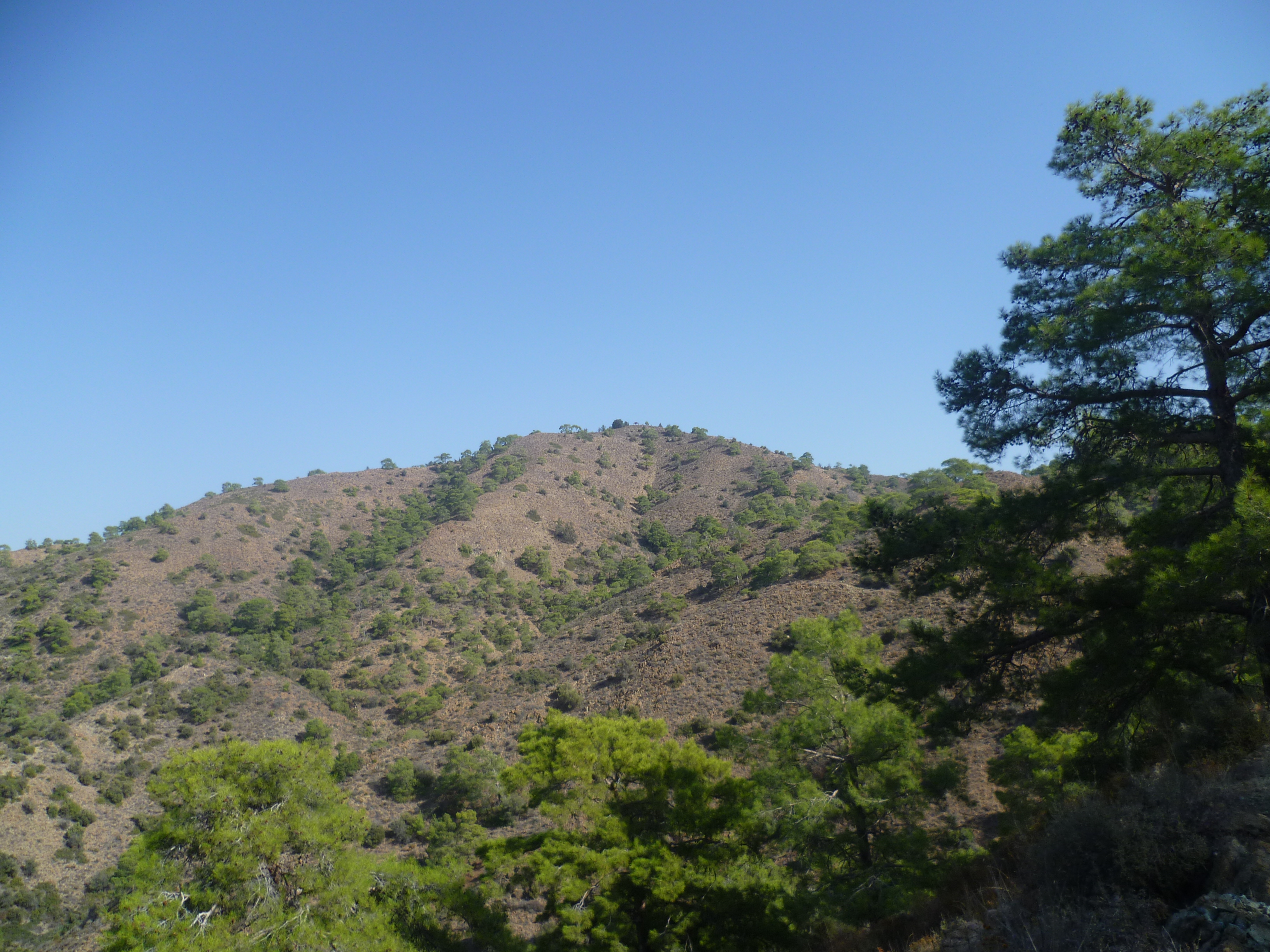
The views start to open out as you climb and about 15-20 minutes after joining this path you will see the summit of Kyparissia high above you with the shelter where you will stop for a well-earned break!
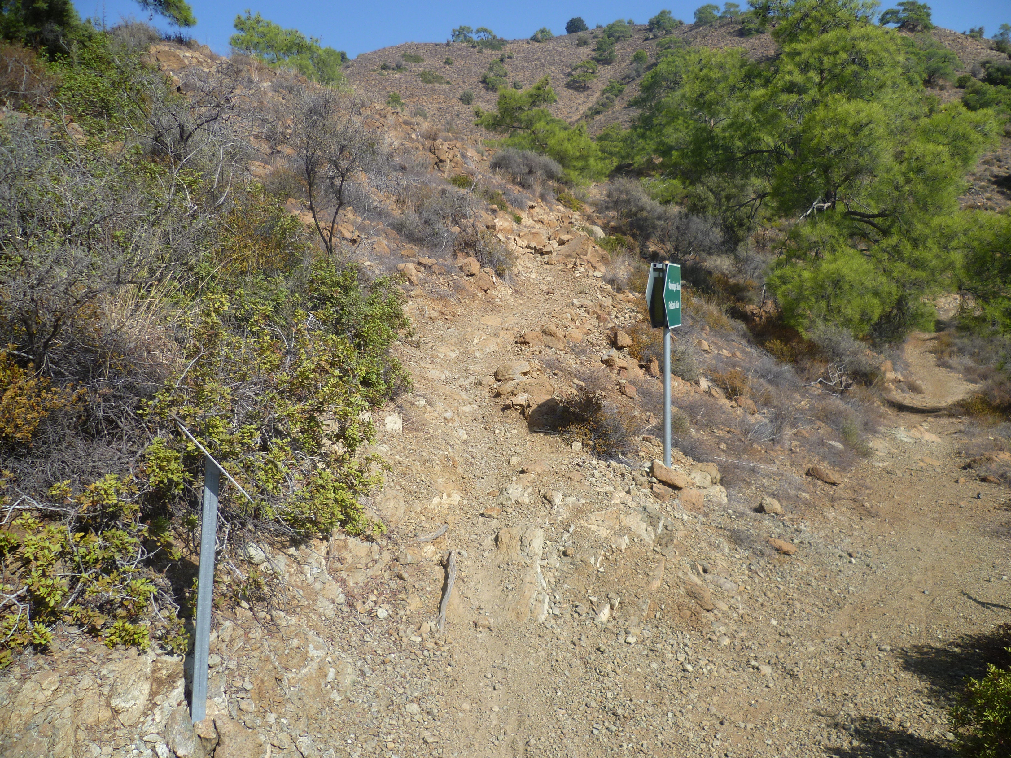
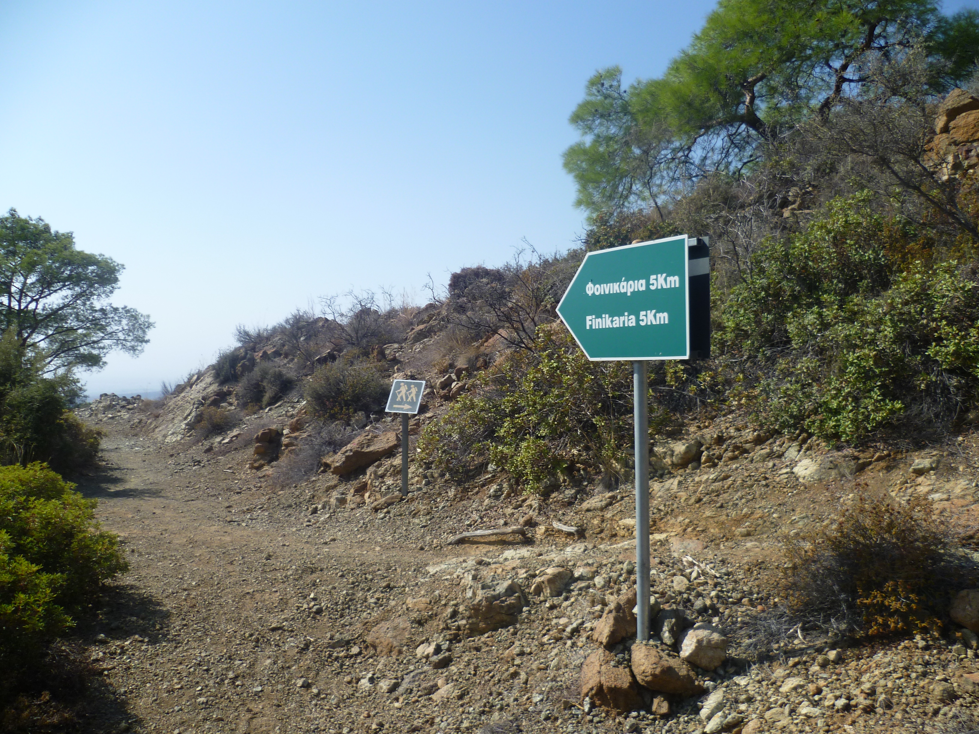
Keep going, climbing all the time, and after about 1 hour 15-20 minutes you will reach a junction of paths with hiking signs and a green signpost back to Foinikaria 5km. Take the left fork uphill – you’ll return down the other path later.
Don’t forget to look back at the wonderful views of Limassol (increasingly dominated, sadly, by the new money-laundering seafront skyscrapers) and Akrotiri as you are climbing. At 1 hour 40 minutes you will reach a lovely shady bench with views across the empty valley. You are almost at the top now, so choose to stop here for lunch or carry on for another few minutes to the shelter!
Keep climbing upwards, ignoring an inviting looking track to your left and taking the right fork onto a path to the shelter. (We followed the left hand track once – it’s lovely, for about half an hour. Then it simply stops and you have no choice but to climb back up the way you came)
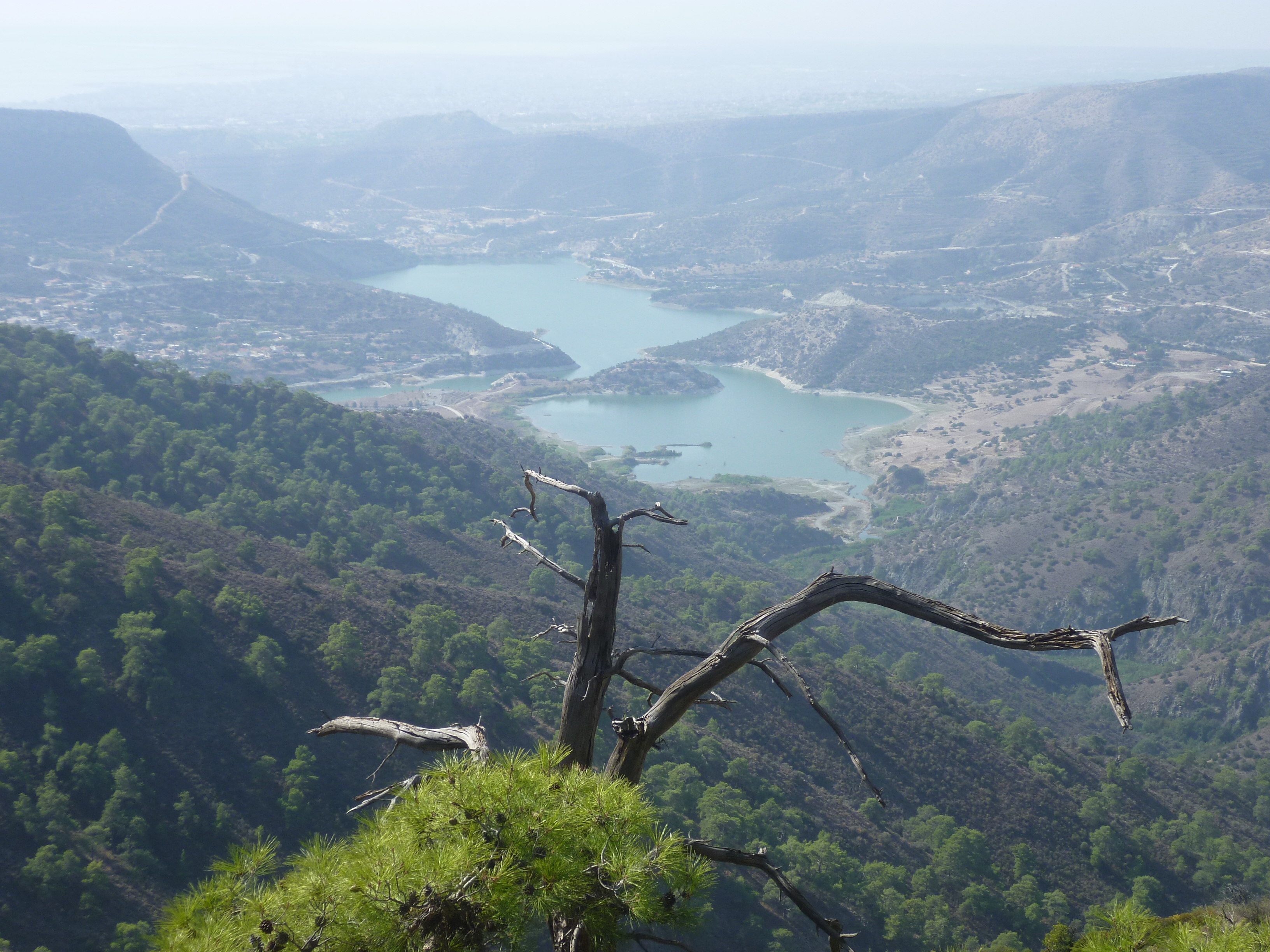
You should reach the shelter after approximately 1 hour 45-50 minutes. [GPS: 34.783015N, 33.120955E] It’s a great spot to sit down, drink some water, catch your breath and eat some of that pastelaki that you have stashed in your rucksack!
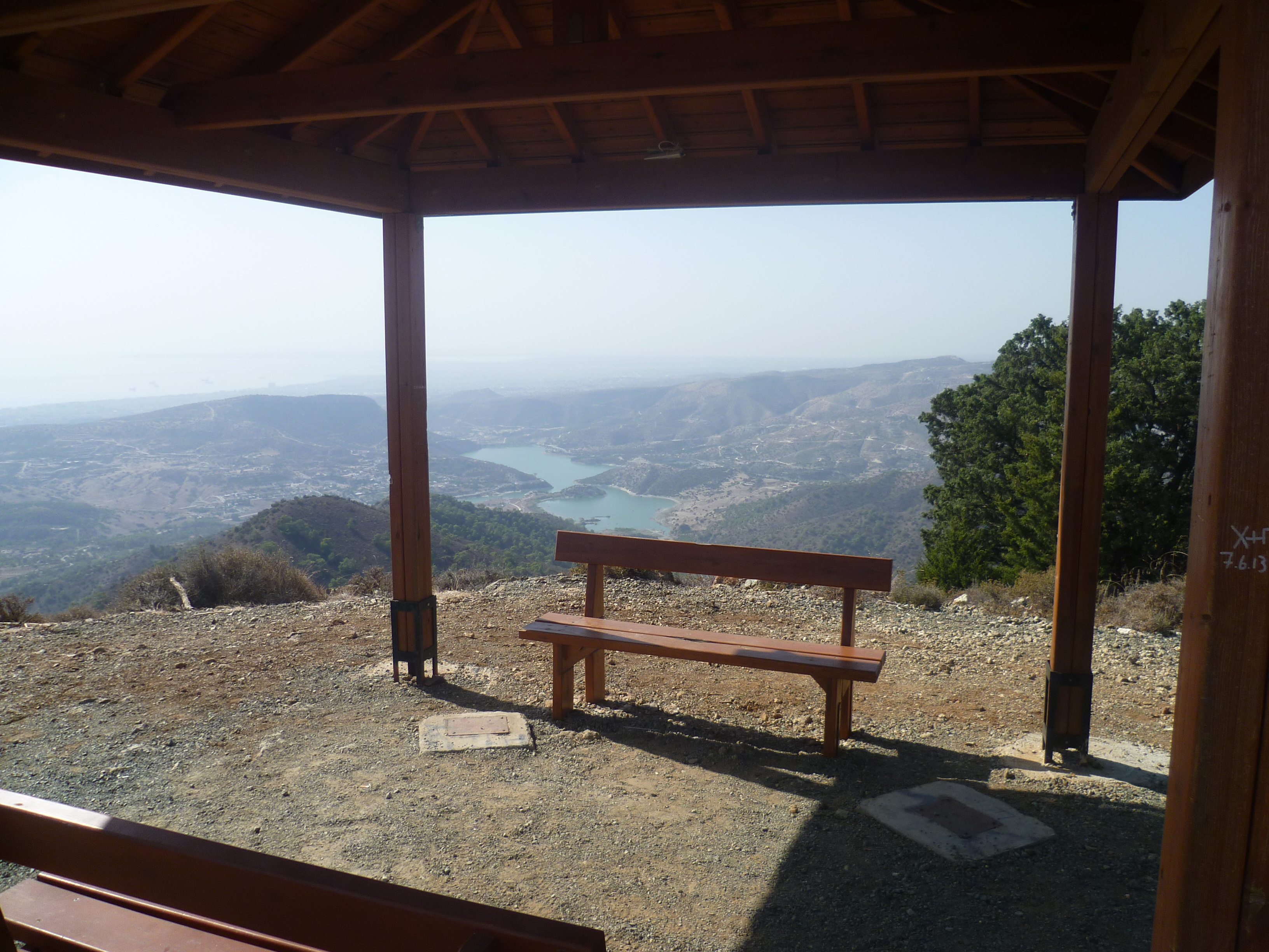
You are at an altitude of 692 metres and, on a clear day, the views down across the southern plains and coast are stunning. On a hazy day they look more like this!
When you are ready to move on, with the reservoir behind you, take the track that heads east from the shelter descending slightly for 70-80 metres, then climbing a little before levelling out across the ridge.
After no more than ten minutes’ walking (2 hours – not adjusted for stops) you will come to a three-way junction with a bench and a sign pointing back the way you’ve just come to ‘Kyparissia Peak’. [GPS: 34.782838N, 33.125272E] Your path is to the right and heads downhill.

A further 50-75 metres further down the hill, take a right turn (following a green hiking sign).
The trail is now very easy to follow as it winds down this pretty valley, crossing the stream (or the stream bed in dry weather) part way down. The shelter on the summit will be high up on your right hand side as you descend the valley. At around 2 hours 25 minutes – and a few minutes after crossing a wooden bridge – you will arrive back at the junction where you turned left at the 1 hour 25 minute point.
Retrace your steps down the hillside to arrive back at your starting point after around 3 hours 30 minutes. That’s without any stops – you’ll probably need to add in 20-30 minutes for breaks as this is quite a strenuous hike uphill and back down.
Birds seen on this walk: Barn Swallow, Black-headed Bunting, Blue Tit, Chaffinch, Chukar, Coal Tit, Common Buzzard, Cyprus Warbler, Cyprus Wheatear, Goldfinch, Great Tit, Greenfinch, Hooded Crow, Hoopoe, House Martin, House Sparrow, Jay, Kestrel, Long-legged Buzzard, Magpie, Masked Shrike, Orphean Warbler, Pied Wheatear, Red-backed Shrike, Redstart, Sardinian Warbler, Stonechat, Wheatear, Whitethroat, Willow Warbler, Wood Pigeon, Woodchat Shrike.
Around Germasogeia Dam itself we’ve seen: Bluethroat, Great and Little egrets, Grey heron, Purple heron and Squacco heron.

Thanks for the guide. As always in Cyprus, finding the starting point of the trail is often the hardest part, and this guide was extremely helpful in finding that elusive starting point–and very helpful and accurate along the route. Good work, thanks!
Jeff: Many thanks for the feedback – it’s always good to know a guide has been helpful! Cypriot walking maps, trails and signs are often vague and frustrating, which is why we started this site! Hope you enjoyed the walk and – I gather – the snow too!! Best wishes – Mark & Jane
Is there a map that shows this trajectory?
Hi Dieter – not really. Cyprus maps are not the same as in western Europe – they are hard to find, rather unreliable and don’t cater for walkers. This is a well-marked walk so you shouldn’t find the trail too difficult to follow. The Sunflower book which we write does contain a map showing the route but I’m not sure it adds a great deal. Sorry! – Mark
Hi, thanks for posting your hikes!
I am a teacher in Limassol, I have been using your ideas to plan some school and D of E hikes recently. I have a couple of different varieties of maps at different scales and of differing ages. I mostly use google earth to plan out the routes though. I’d be happy to share some of my google earth routes with you from around the island if you want them?
Just wanted to ask about your book, is it available to buy in Limassol?
Andrew