Date Last Walked: November 2023
Distance: Approx 10 miles (16 kms)
Duration: About 4 hours 35 minutes (excluding stops)
Difficulty: This is a well signposted route. It does involve an ascent and descent of some 600 metres so can be regarded as fairly challenging.
GPX file available on request
The walk starts in the picturesque village of Spilia on the F944 to the north east of Troodos. Follow the lower road through the village (signposted towards Kordali) and park up just near the sandy football pitch on the way out.
GPS co-ordinates are 34.968056N 32.957547E
You will then need to walk back round a right-hand bend towards the village and in a couple of minutes pick up a nature trail on your left.
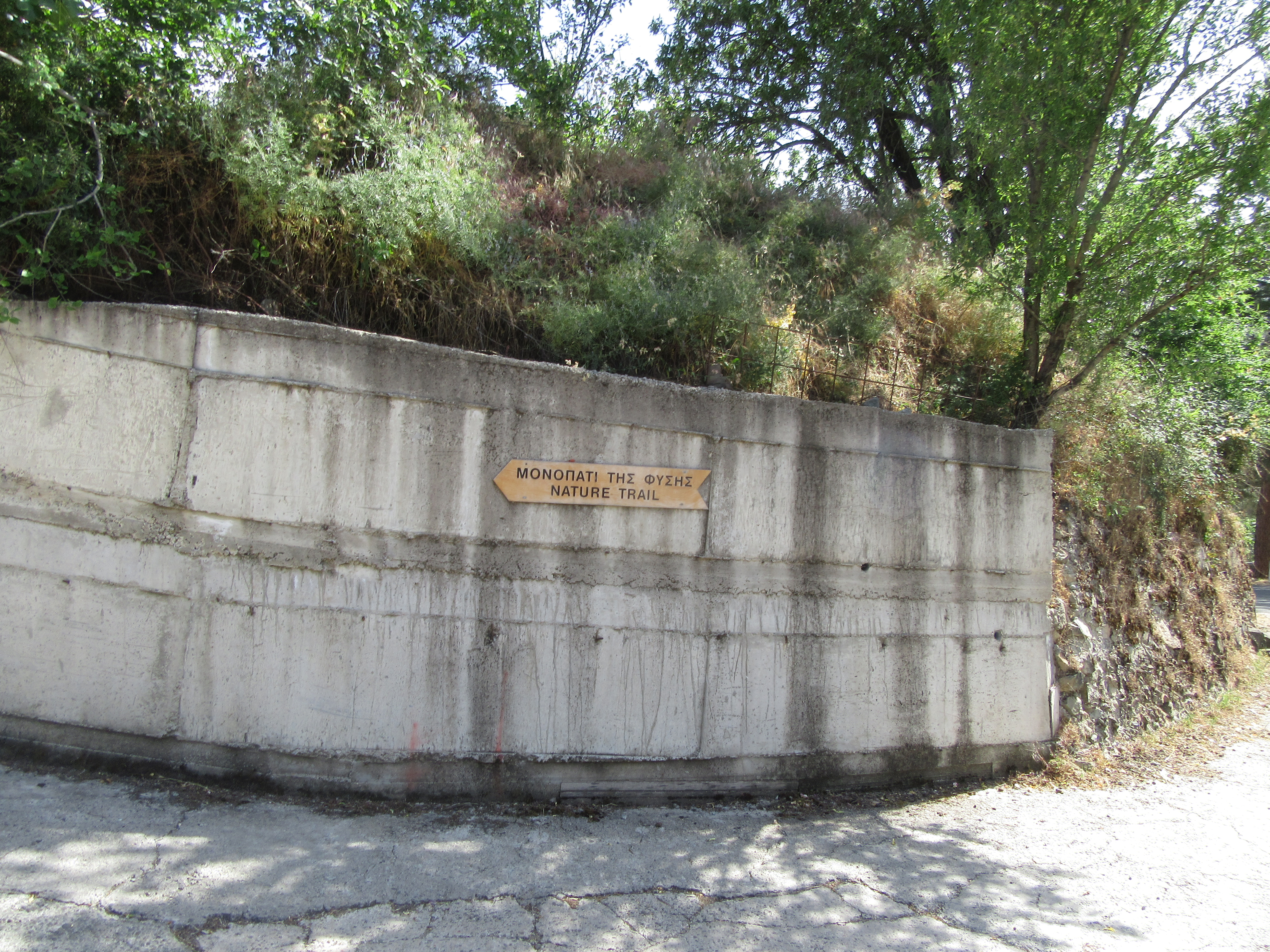
Follow this clearly signposted trail as it climbs at first on a concrete road then veers off left to reach a shady spot with a water tap underneath a large plane tree after 4 minutes. Notice the sign indicating the rather sinister sounding ‘Tomb of the Plague’. Legend has it that the Virgin Mary destroyed the plague that was killing the residents of Spilia by chasing it up the hillside and crushing it between the two large, strangely shaped rocks that you can see above yo.
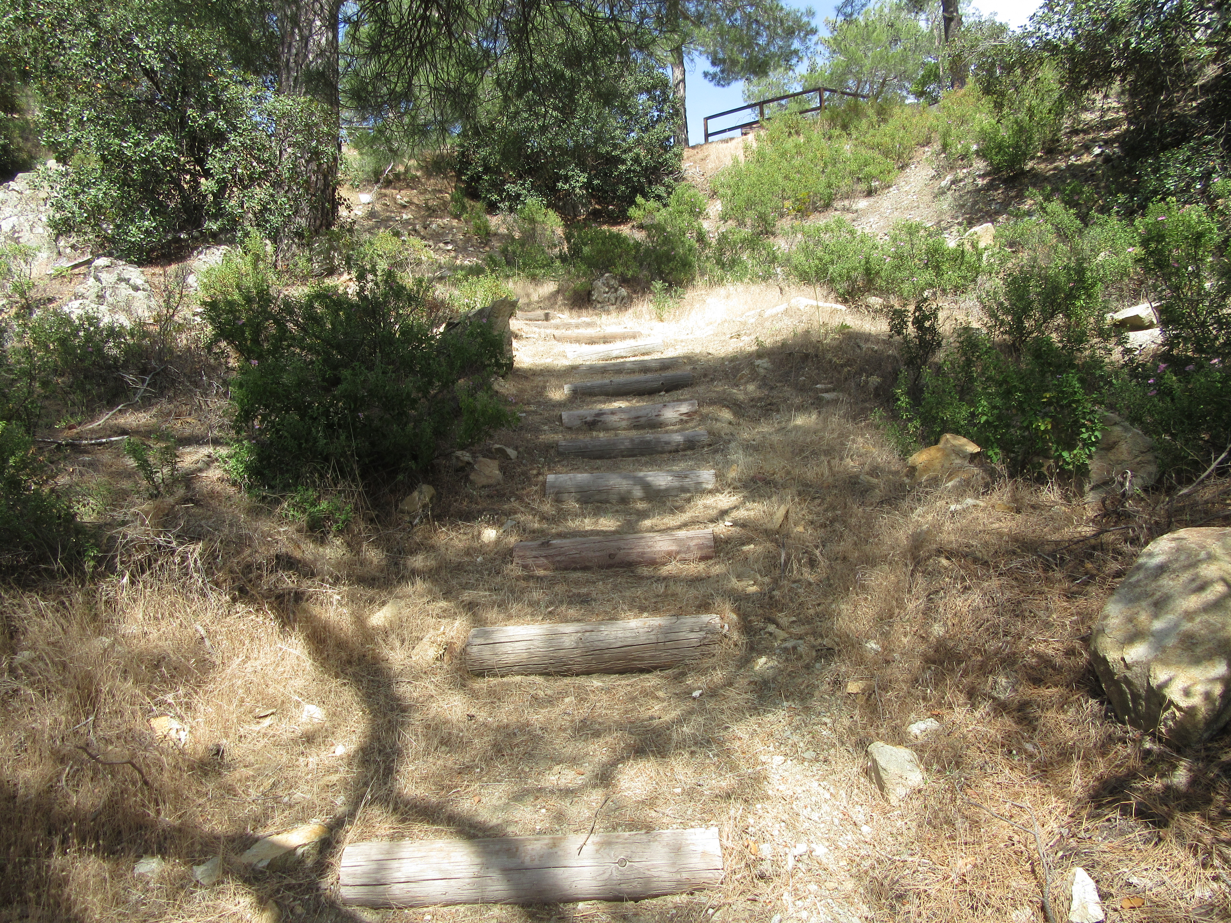
Follow the trail sign to Moutti tis Choras 600m and after 9 minutes leave the road to continue on the trail up a grassy path next to a telegraph pole. Climb the path and the wide wooden steps.
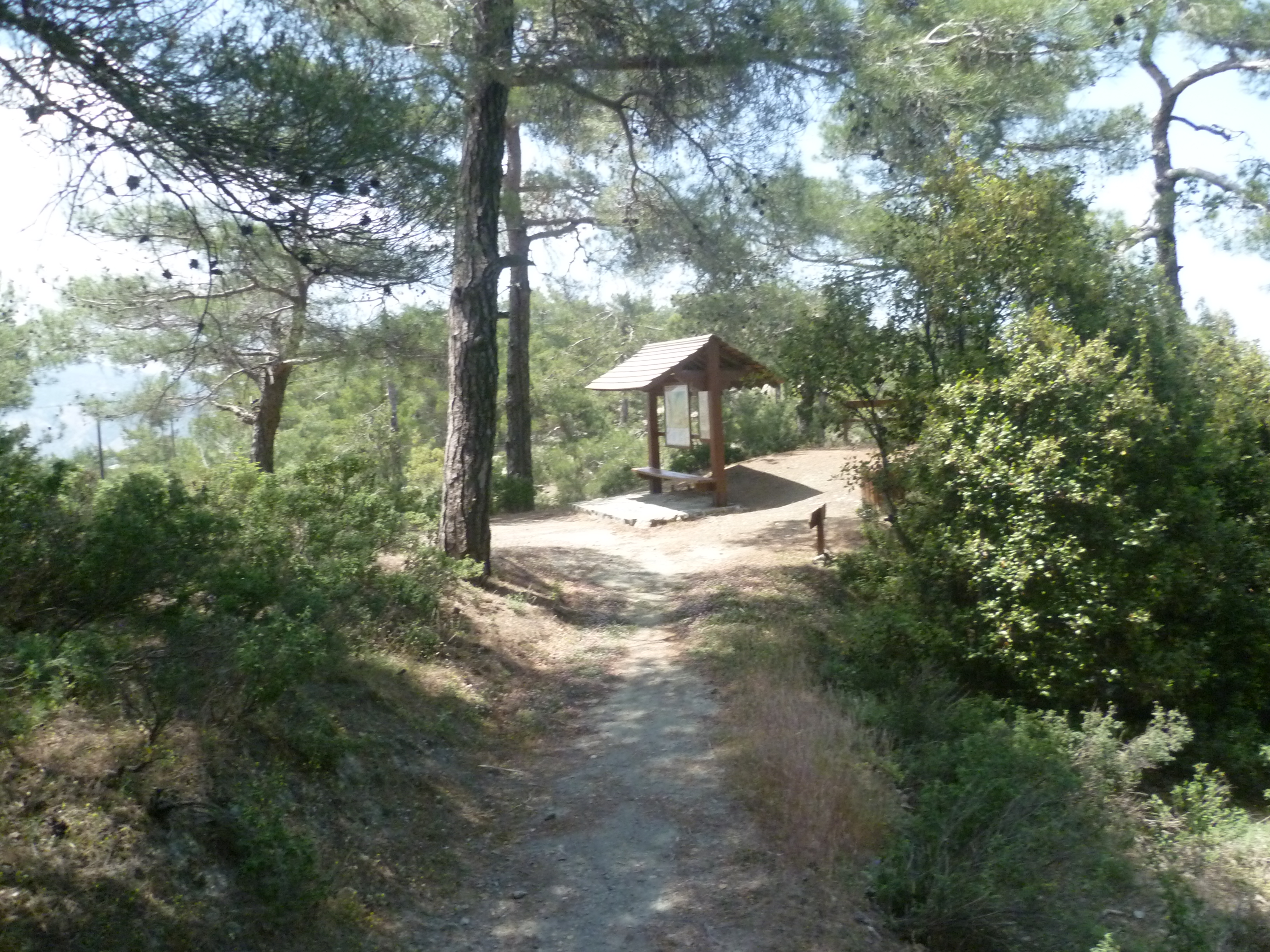
After 20-25 minutes you will reach a sign to ‘Other Trails’. Cross the road here to reach Moutti tis Choras and the nature trail board. GPS co-ordinates 34.967886N 32.961951E.
NOTE: If you wish to knock 50 minutes or so off the overall length of the walk – as well as alleviate some of the climbing and descending! – you can drive to this point in order to start the walk. Spilia, though, is an interesting village and worth a look around at the end of the walk.
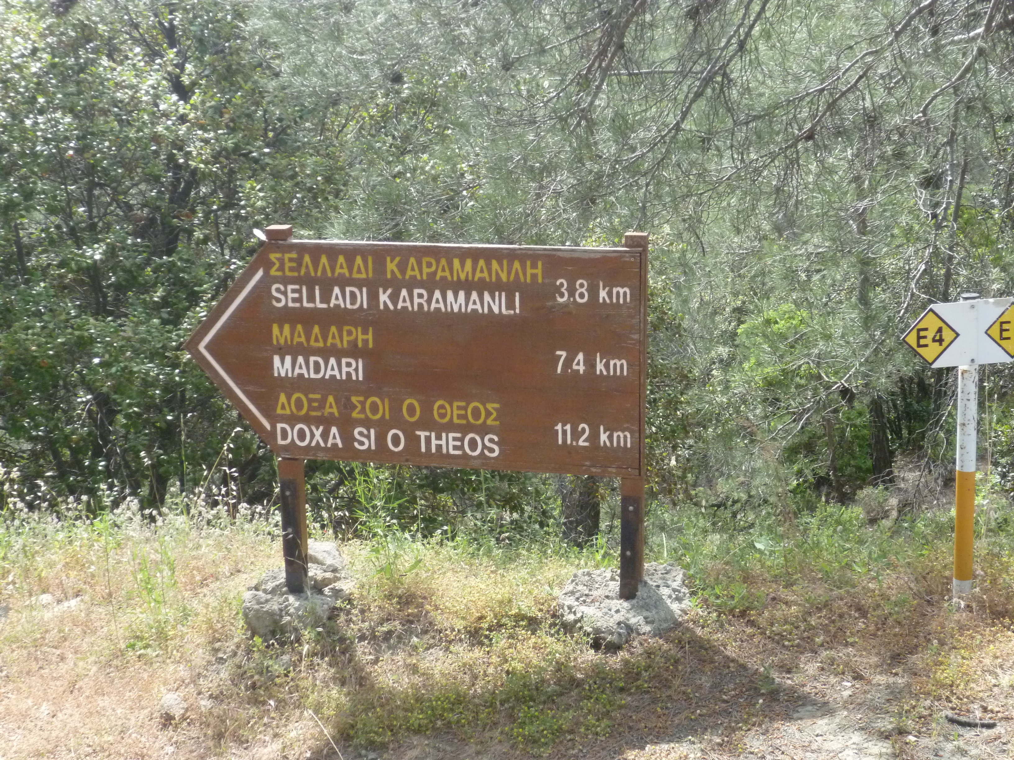
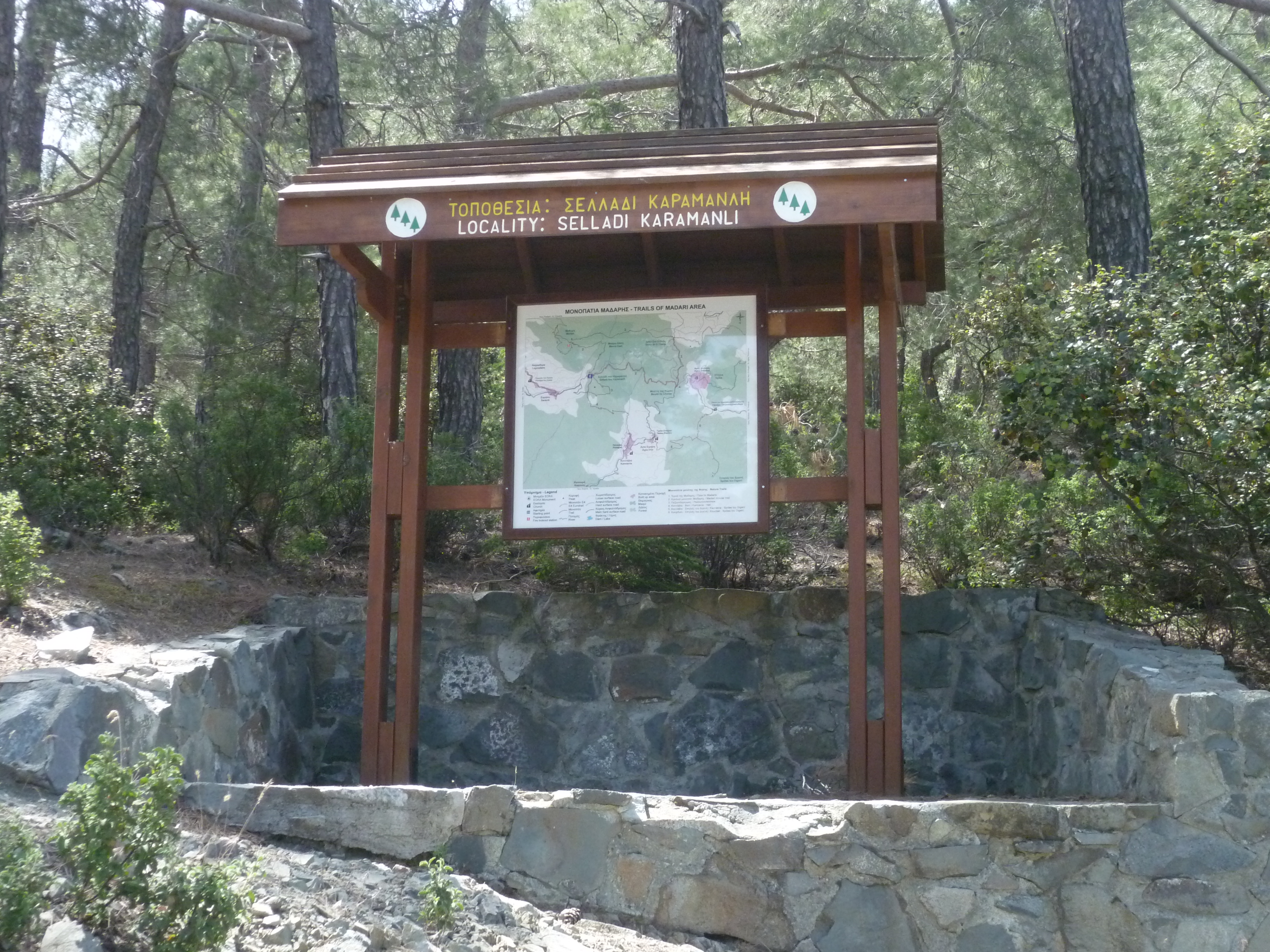
Take the path signposted to ‘Selladi Karamanli 3.8km’.
The path undulates through shady pine forest, first descending then climbing back up towards the ridge. Follow the E4 route signs and look out for views of Madhari ridge and the fire look-out station high up to your right. At 1 hour 30 minutes you will arrive at Selladi Karamanli
GPS co-ordinates 34.965085N 32.988161E
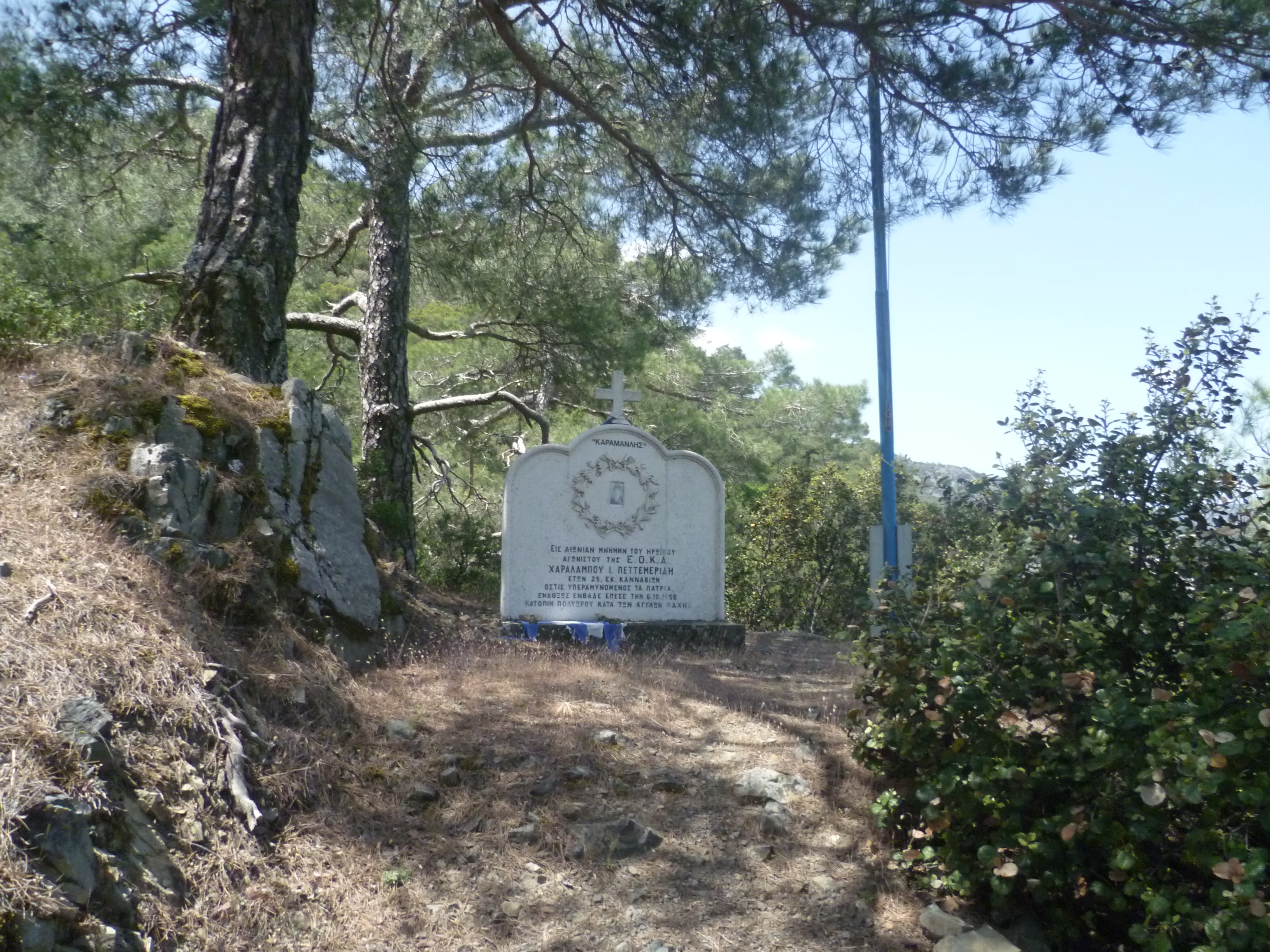
Take a couple of minutes to catch your breath and to look at the memorial to Charalambos Petmeridos who died in 1958, aged 25, fighting for EOKA.
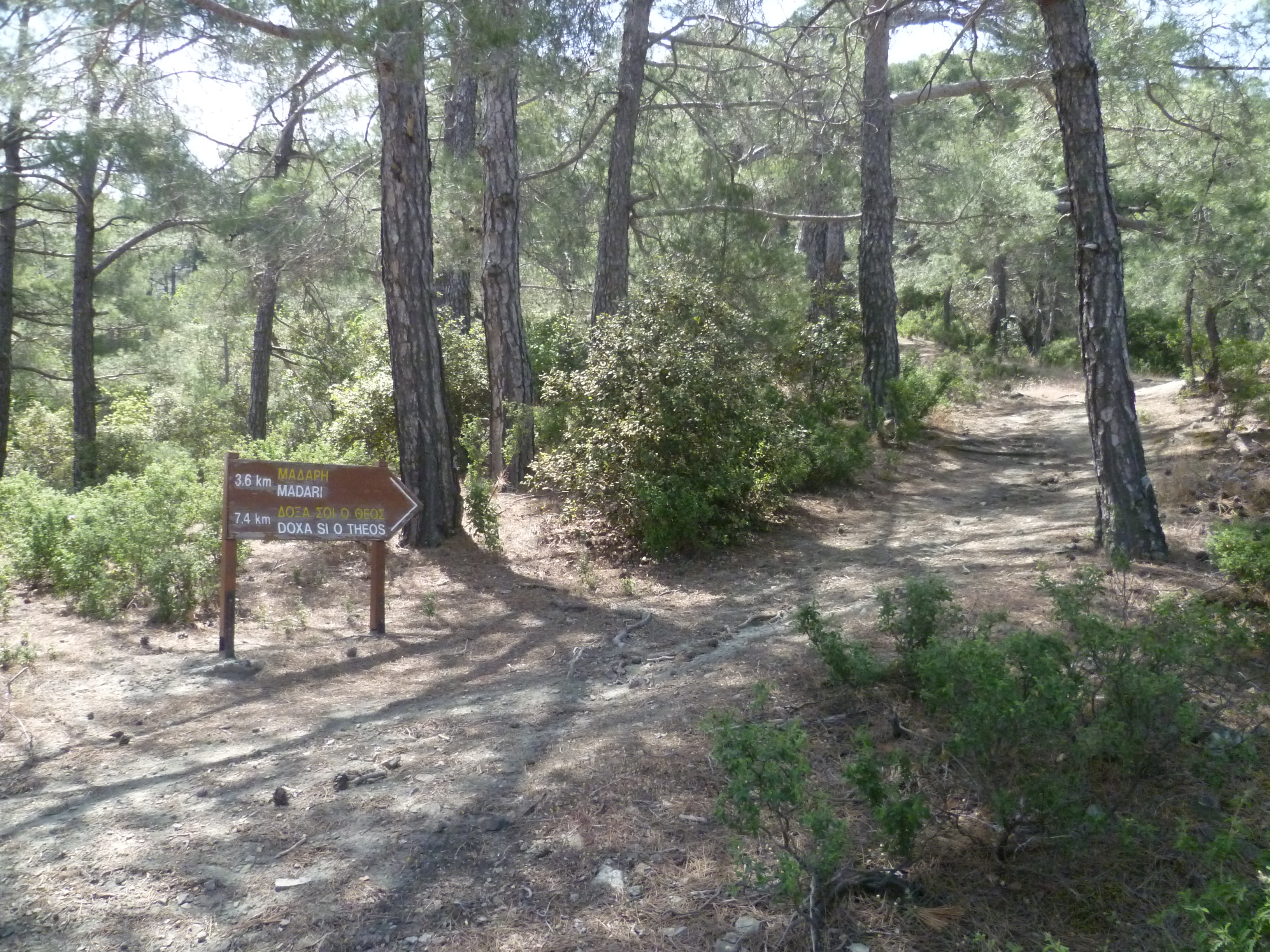
Then take the path to the left of the nature trail board which is signposted to ‘Madari 3.6 km & Doxa Si O Theos 7.4km’
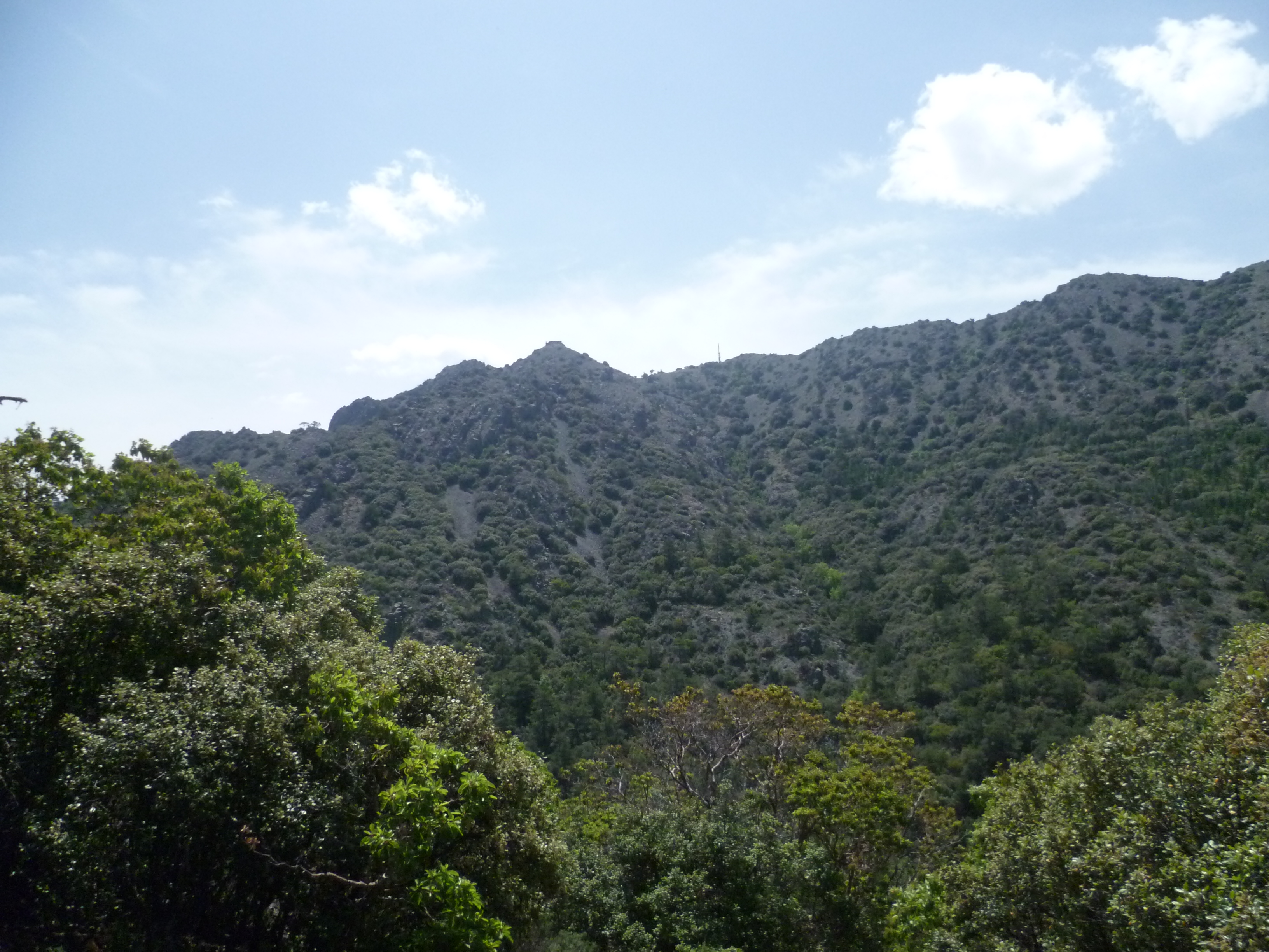
The path climbs towards the ridge, and after 10 minutes you reach a saddle where the view opens out. Ahead of you in the distance you can see your next destination high above you: the fire look-out station at Adelfoi.
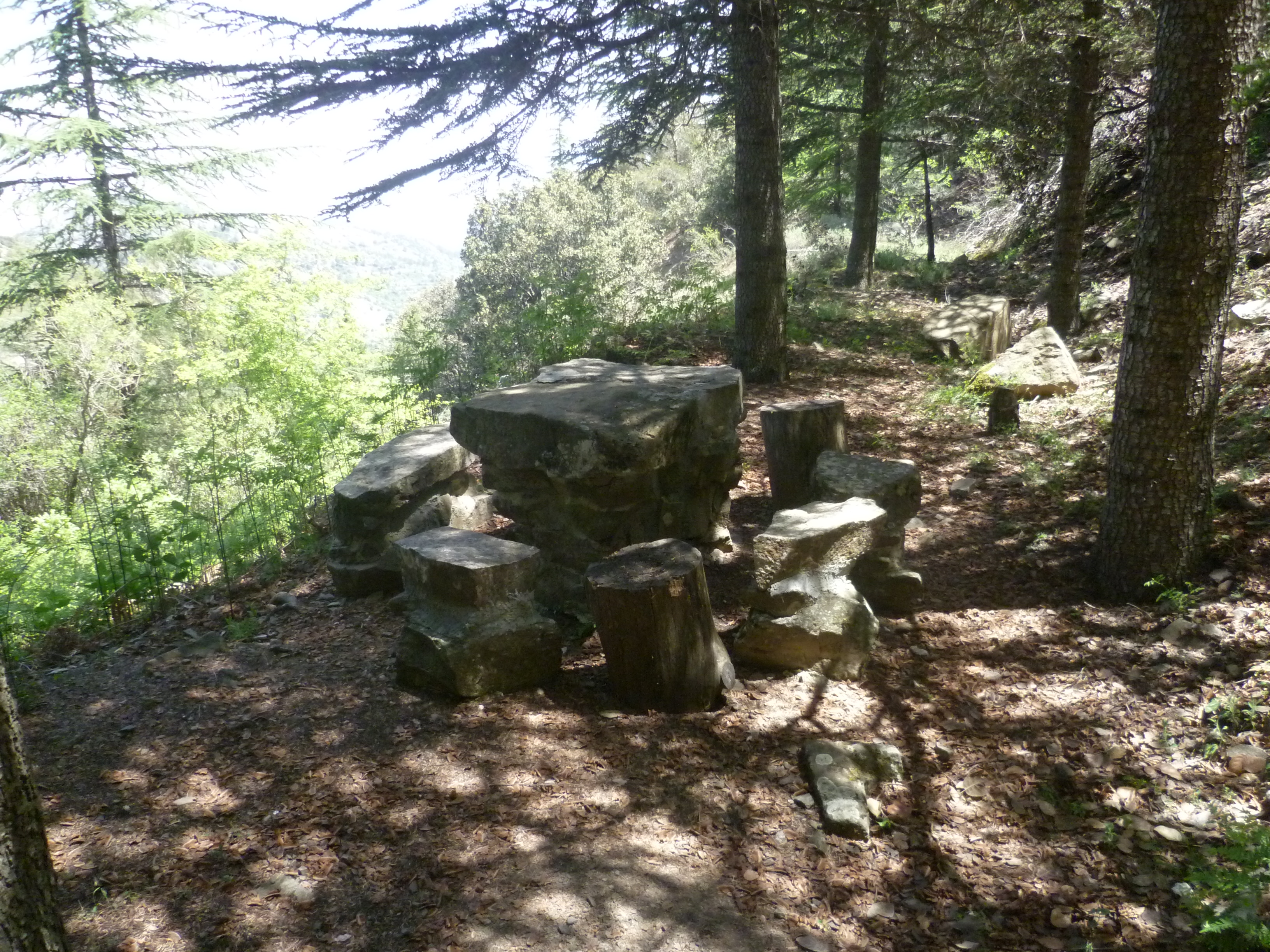
After 2 hours you will pass a rustic stone table and chairs with a marvellous view across the valley. When we walked this route in early May wild peonies looked lovely scattered across the hillside. Take advantage of this shady spot before continuing along the trail and starting to climb up toward the ridge.
After 2 hours 30 minutes you will reach a nature trail board just below the fire station. GPS co-ordinates 34.956238N 32.957547E.
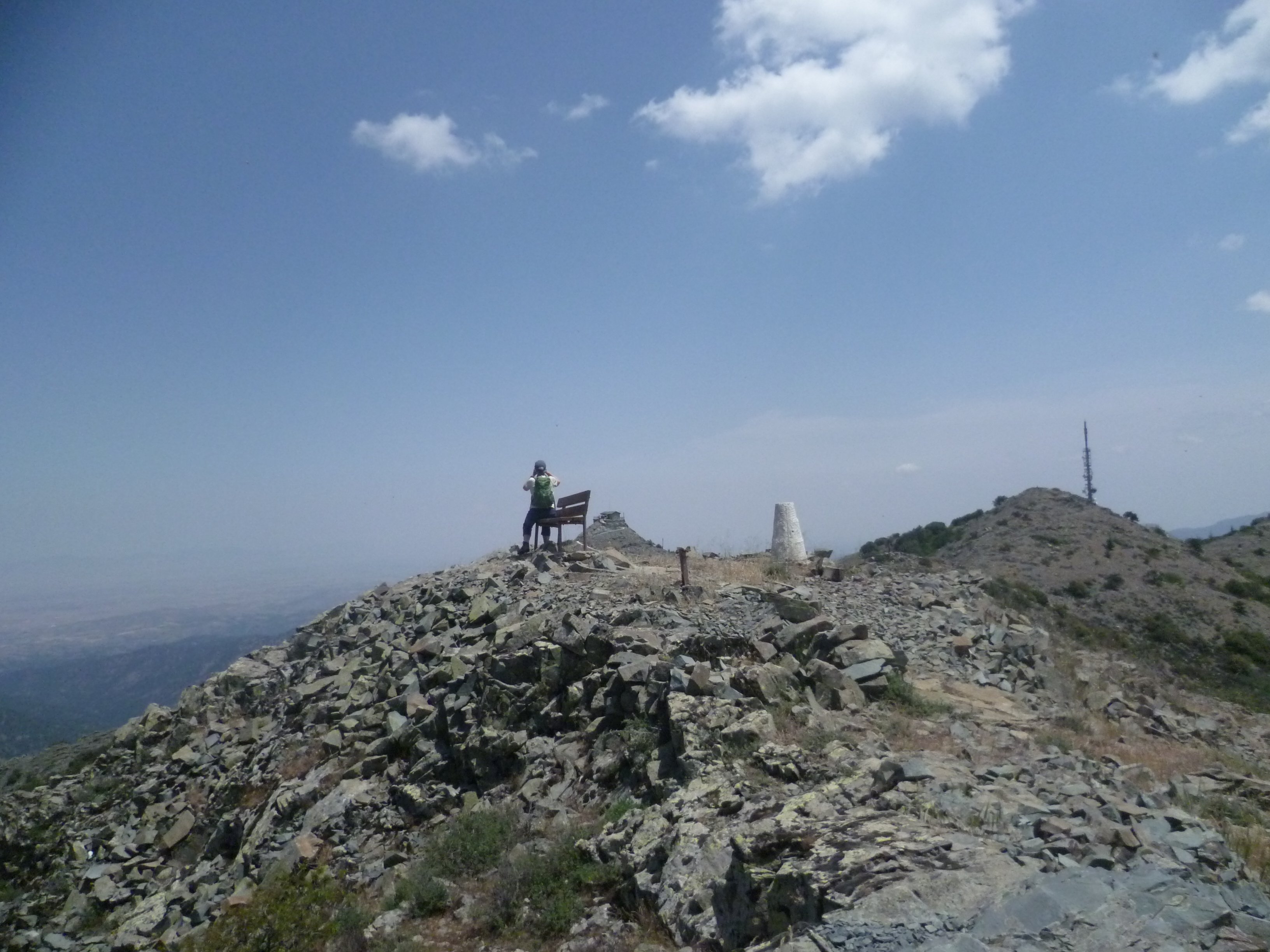
You are now on the Madari ridge. It’s worth climbing for a few more minutes up to the fire look-out station at the Mount Adelfoi summit to admire the wonderful views.
NB If you would like to extend this walk by 3.5km you can add the Teisia tis Madaris circuit at this point. It’s a lovely walk which takes you around the mountain just below the fire look-out station. You’ll see some interesting rock formations and more wonderful views as the path winds around and returns to the start point by climbing the crazy paving road. If you decide to do this add about an hour to the timings from now on.
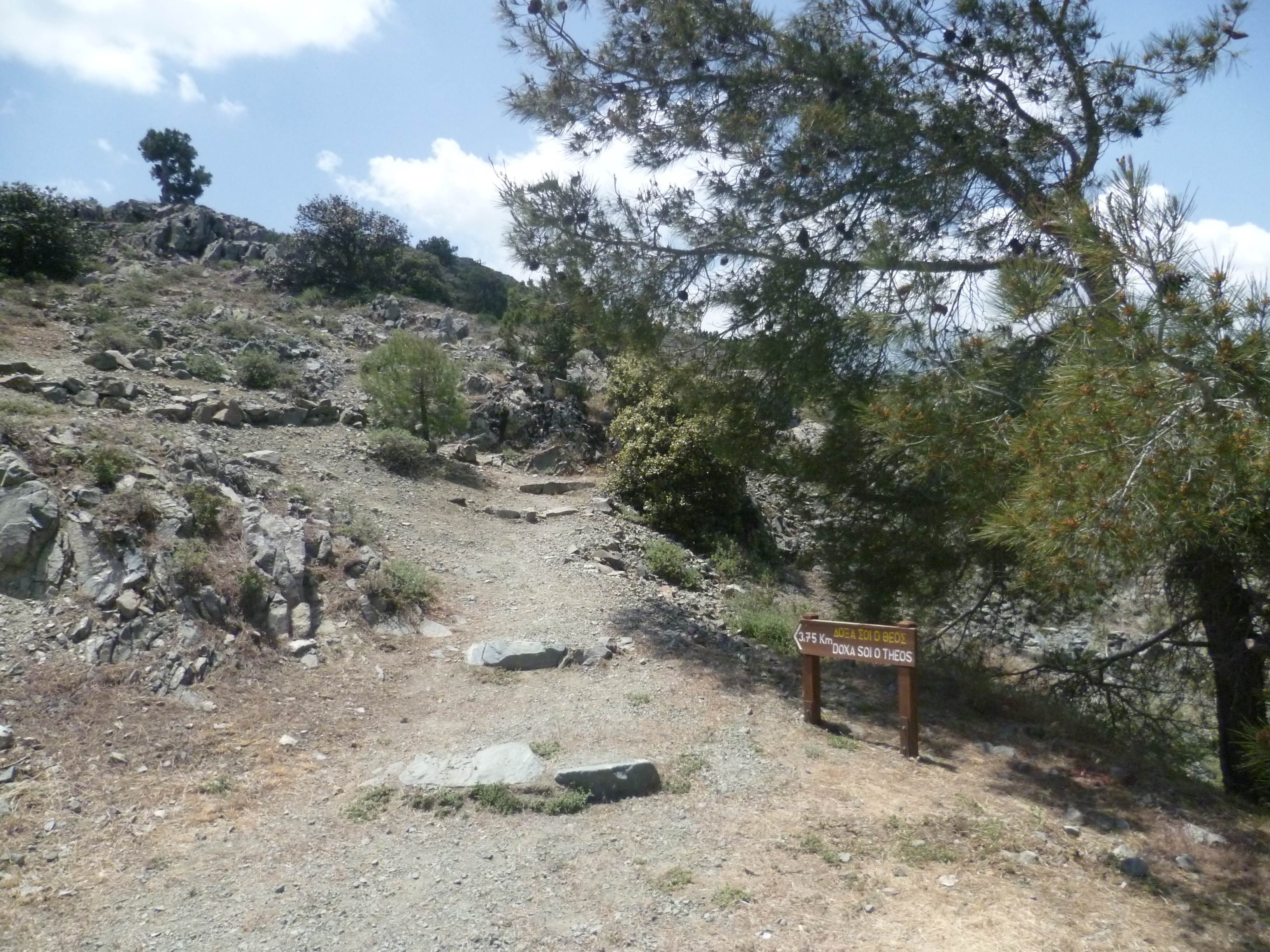
Whichever option you choose, return to the nature trail board and when you are ready to continue, take the path signed to ‘Doxa Soi O Theos 3.75km’.
As you walk along the ridge, you will have views down to Kyperounta to your left and to the north coast on your right. You may wish to take advantage of an ‘excellent viewpoint’ after 2 hours 40 minutes

The route continues along the top of the ridge before starting to undulate and eventually descend, quite steeply at times, to reach the nature trail board at Doxa Si O Theos after about 3 hours 45 minutes. GPS co-ordinates 34.955860N 32.963037E.
There is a tap with drinking water here.
When you are ready to continue, turn right onto the asphalt road and after a few metres you will see an E4 sign and a wooden board pointing to ‘Moutti tis Choras 1.8 km’.
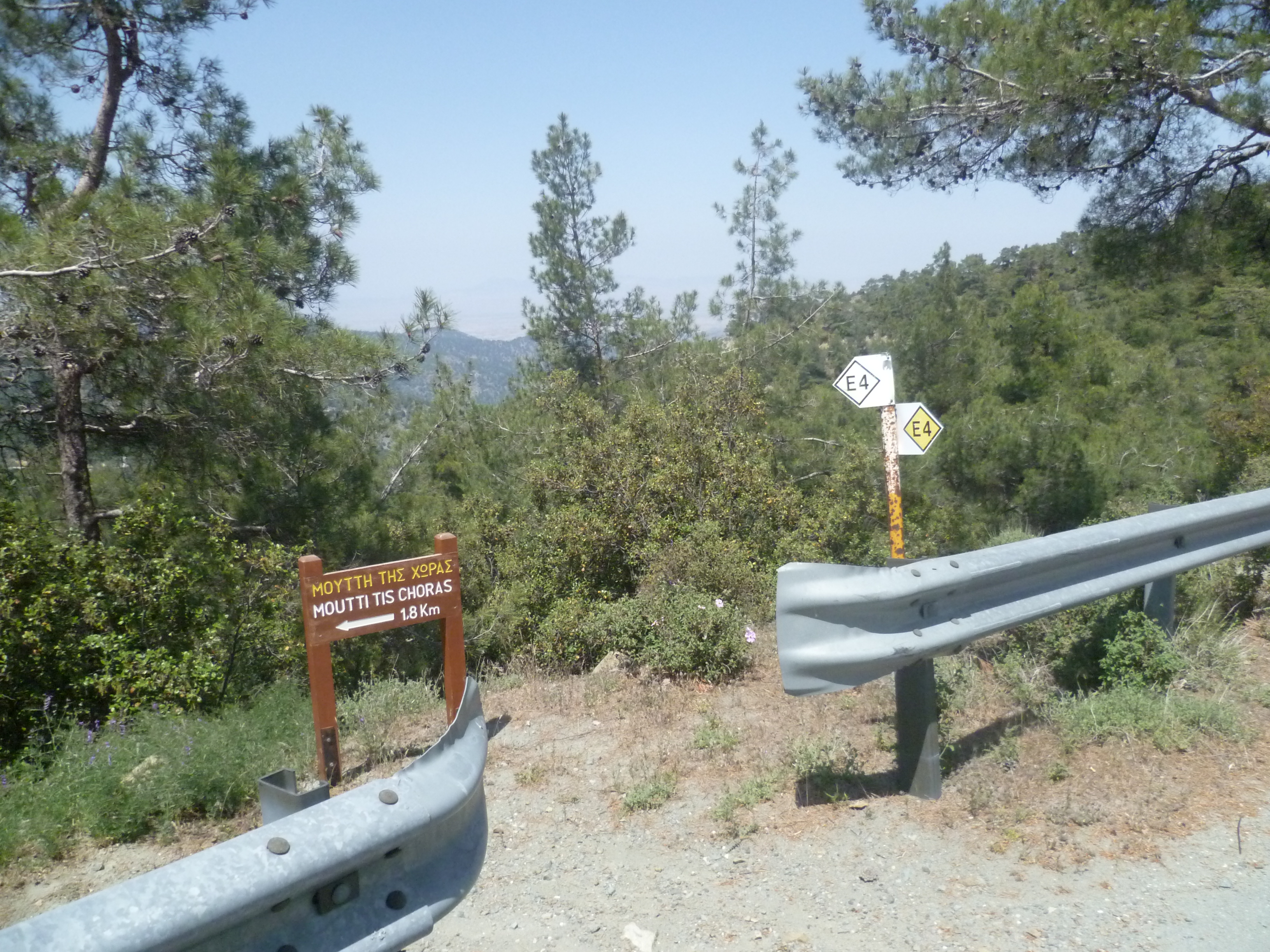
Take this path downhill as it runs alongside and above the F944. You will arrive back at Moutti tis Choras (4 hours 15 minutes) and, from there, can then easily retrace your steps along the nature trail to return to your car. (4 hours 35 minutes)
Birds seen on this walk: Barn Swallow, Blackbird, Blue Rock Thrush, Chaffinch, Chiff Chaff, Chukar, Coal tit, Collared Dove, Crag Martin, Cyprus Wheatear, Feral Pigeon, Goldfinch, Hooded Crow, House Martin, House Sparrow, Jay, Magpie, Masked Shrike, Ortolan Bunting, Pied Wheatear, Rock Dove, Swift, Wood Pigeon.
