Kathikas – Agiasmata Nature Trail – Kathikas
Date Last Walked: October 2022
Distance: Approximately 5 miles (8 kms)
Duration: 1 hour 50 minutes (Shortened versions of the walk – at around 1 hour 20 minutes and 1 hour 35 minutes – are also included within the text below)
Difficulty: Fairly easy walking with some graduated ascent/descent. Very little shade.
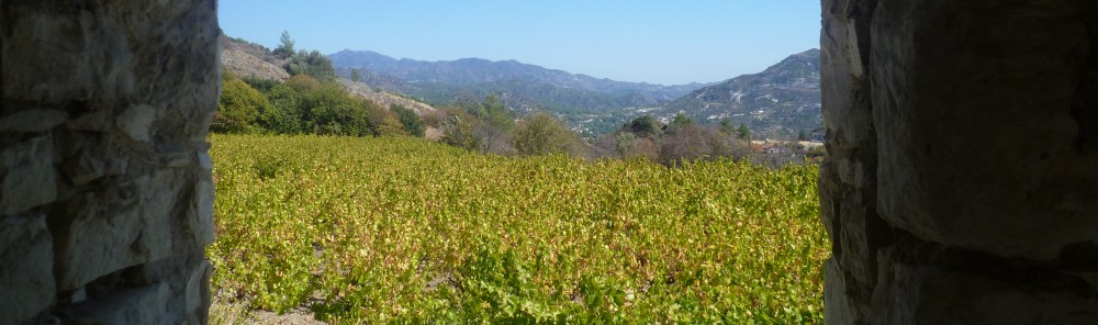
This is a fairly short and comparatively easy walk in countryside just to the north of Paphos. It’s worthwhile for some great panoramic views across a deep ravine and over the coastline of Coral Bay. It also passes close by a donkey farm – increasingly rare on the island these days – so if you like to listen to the strange sound of orchestrated braying echoing off the walls of a ravine then this is definitely the walk for you!
A word of warning before you start, though: the nature trail at the start of the walk is absolutely fine in decent weather (which in Cyprus means pretty much all the time!) but, after periods of sustained rain the uphill path can apparently turn into a mudslide. We’ve personally never had any trouble with this – we walk mainly in April/May and October/November – but we gather that, early in the calendar year, this may be a potential problem.
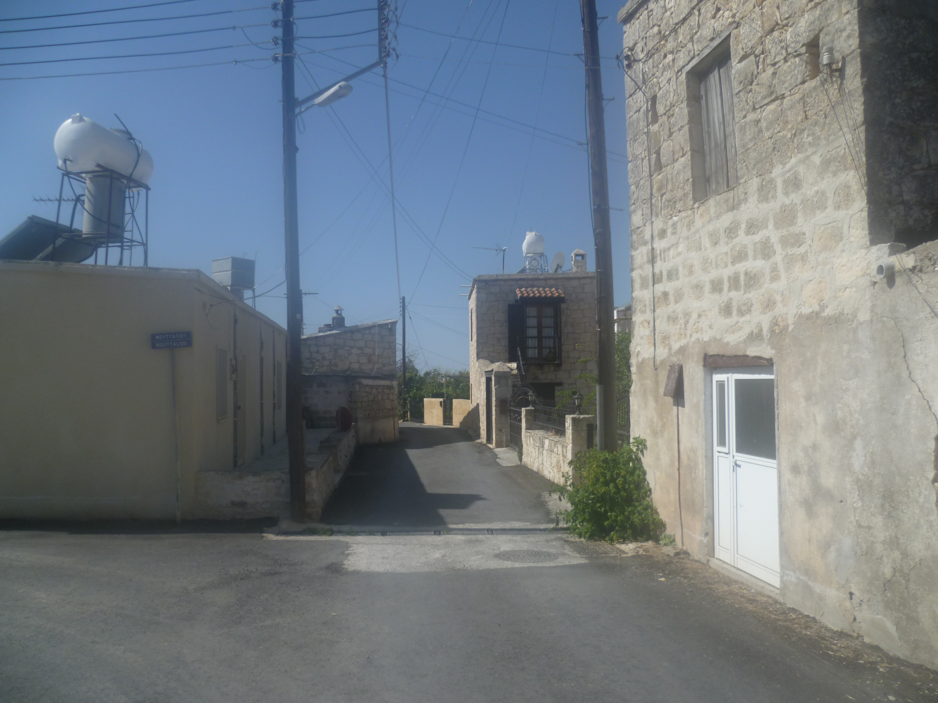
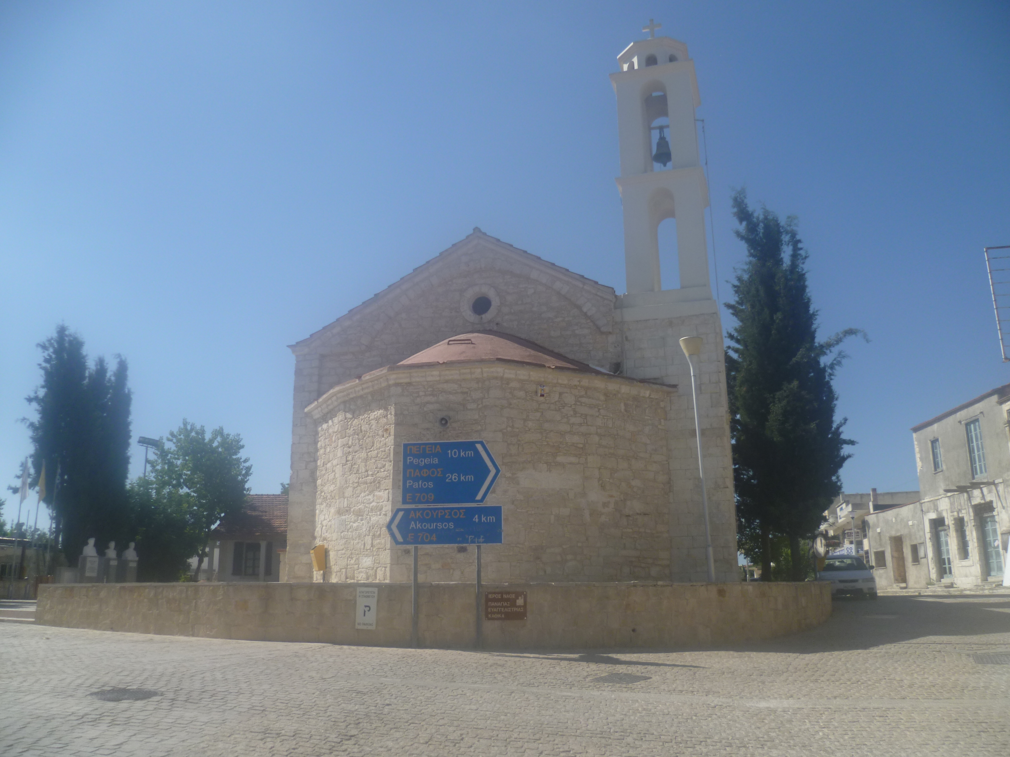
Start the walk in the centre of the pretty village of Kathikas, on the E711 north-west of Stroumpi. It doesn’t particularly matter where you begin as this is a circular walk but we generally leave our car in the (signed) free car park just beyond the central church and cafés on Charalambous Kalaitzi Street.
Start the walk by take this same road heading south out of the village which is signposted towards Akoursos.
After approximately 250 metres turn right down Agiasmatos Street. Follow this road all the way through the village (ignoring Moutalliou Street on your left) as indicated below…
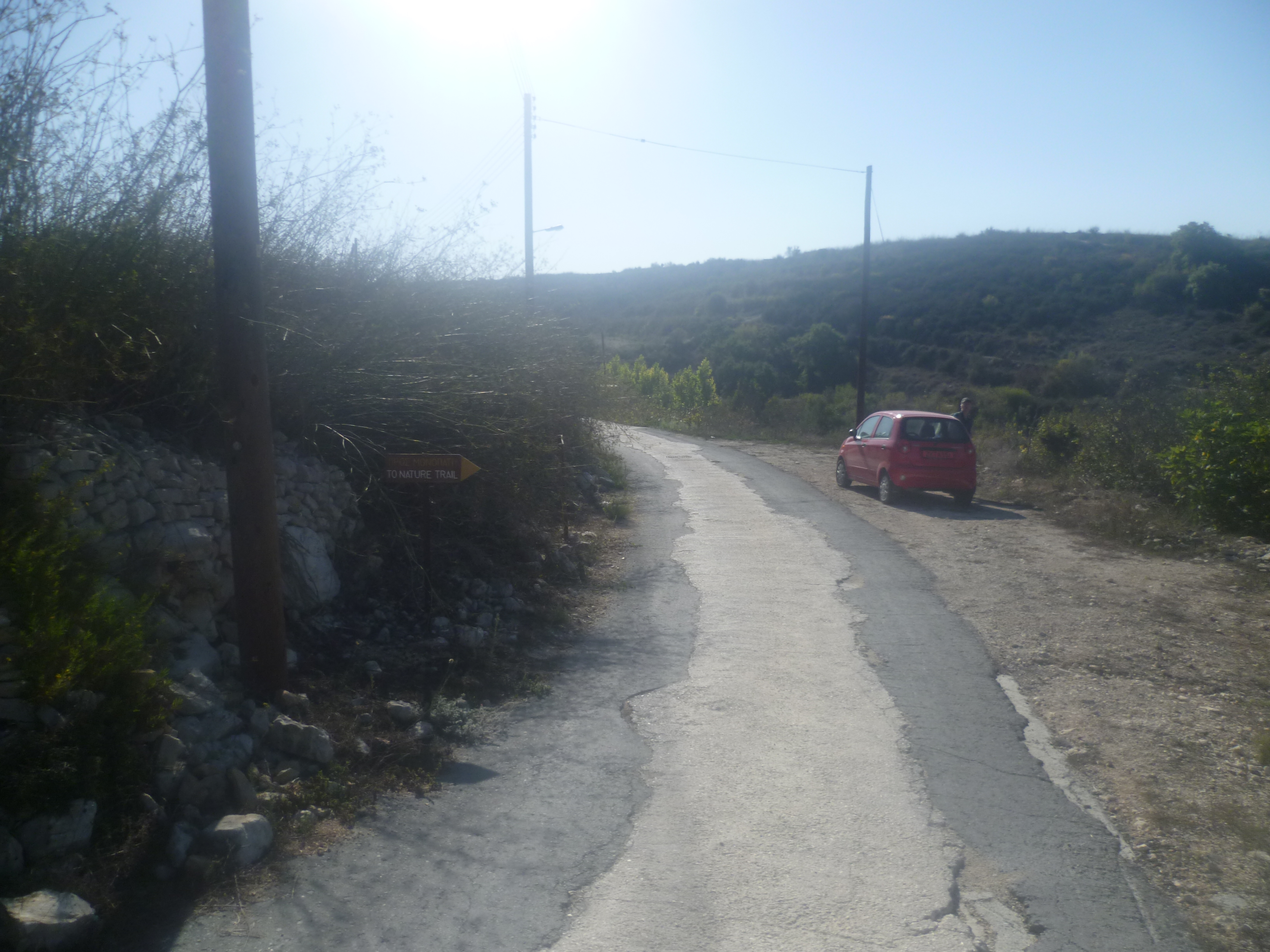
… and out into a countryside of vineyards. You will eventually arrive at a sign indicating Agias Marinas Street. The start of the Agiasmata Nature Trail is approximately 30-40 metres beyond the street sign on your right and is usually marked by a trail board. (15 minutes)
In case the board is missing – a not uncommon experience in Cyprus – the trail can be identified by counting four telegraph poles from the street sign on the left hand side. The start of the trail is directly opposite the fourth pole, marked with the identifier 3/82/13/11. The photos below should help:

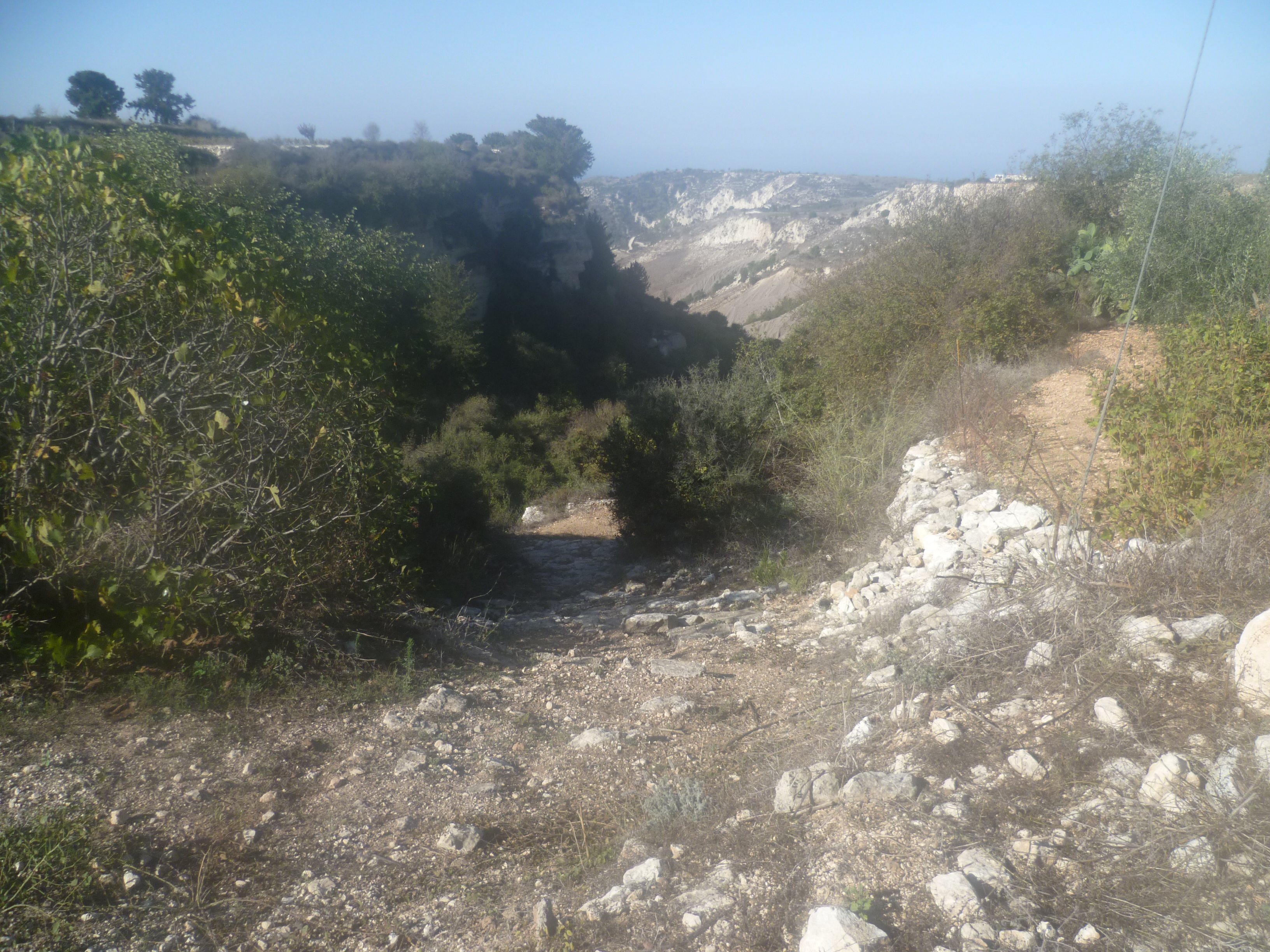
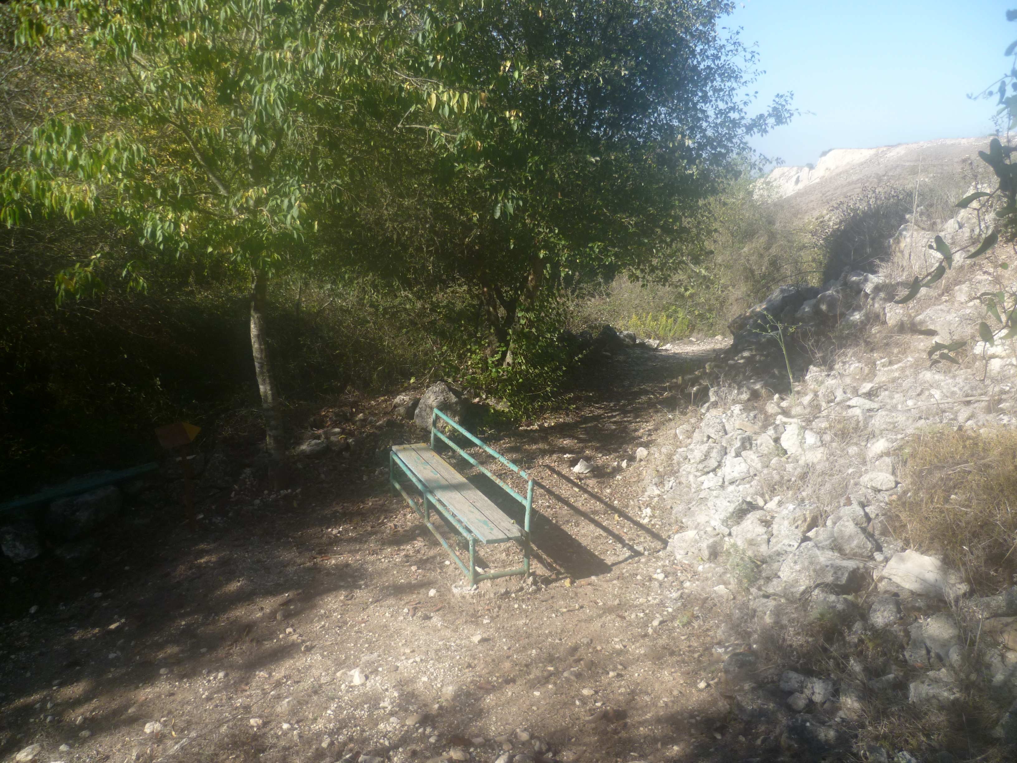
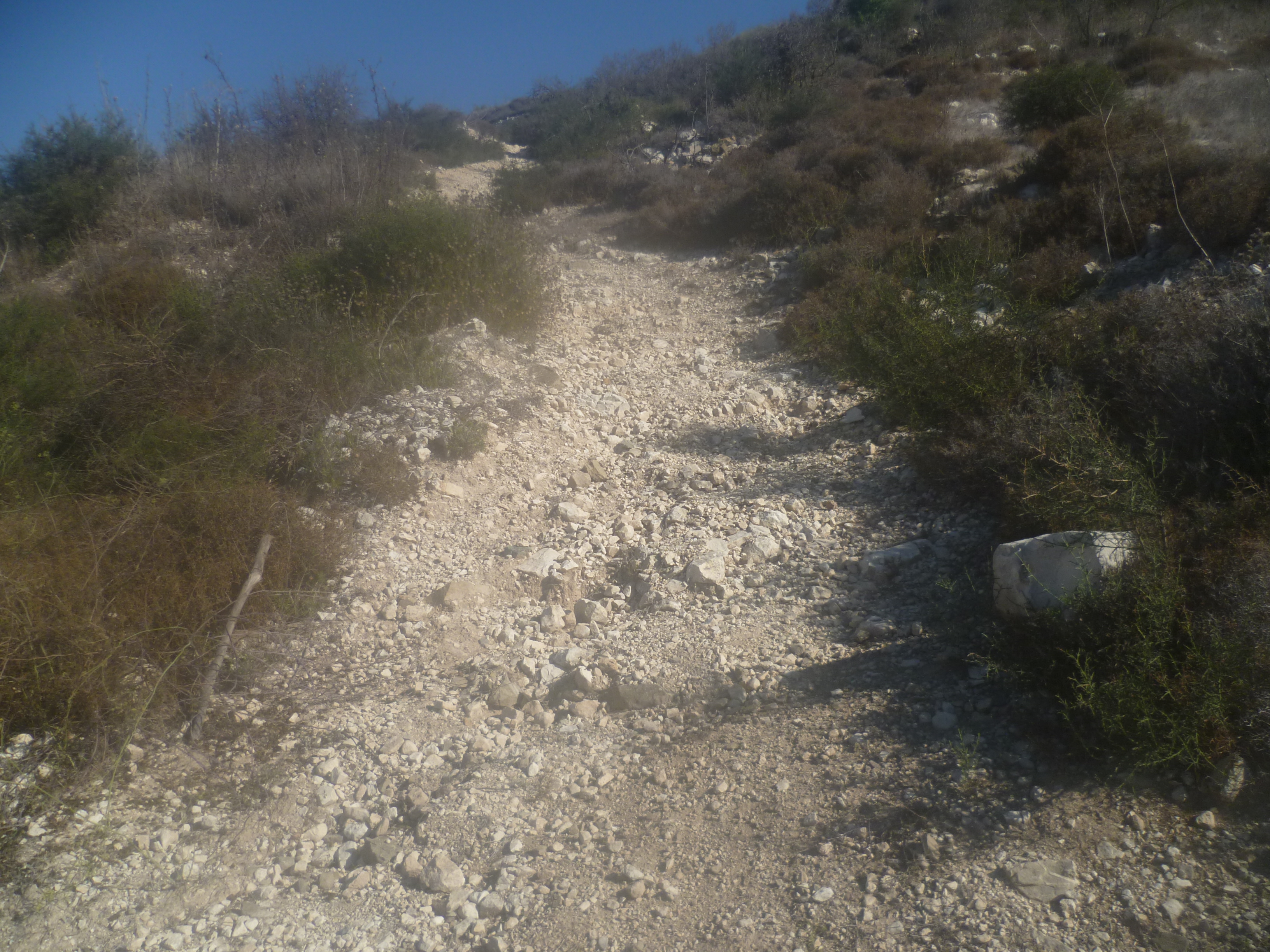
Walk down the rocky path as it descends to the valley bottom. A tree has fallen across the pathway, but it’s easy to duck underneath and continue downhill to reach a spring and some benches (20 minutes).
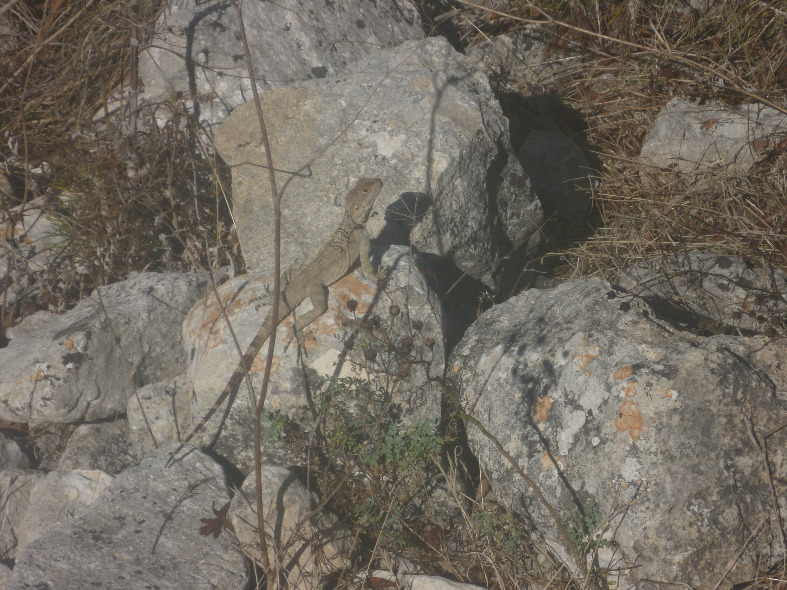
Follow the path along the floor of the valley for a short distance. You’ll be accompanied by dozens of scurrying lizards and the occasional gecko keeping a beady eye on you.
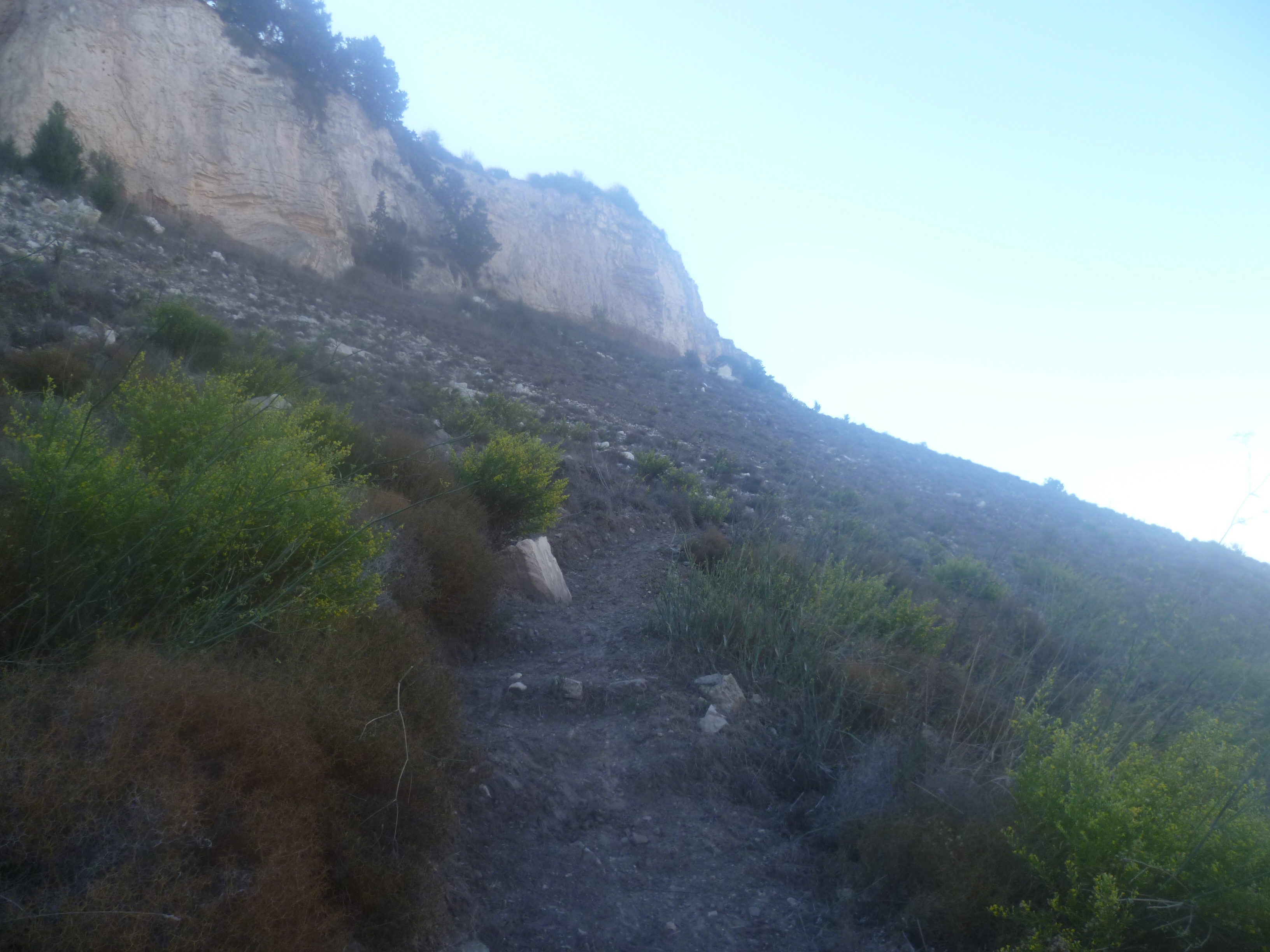
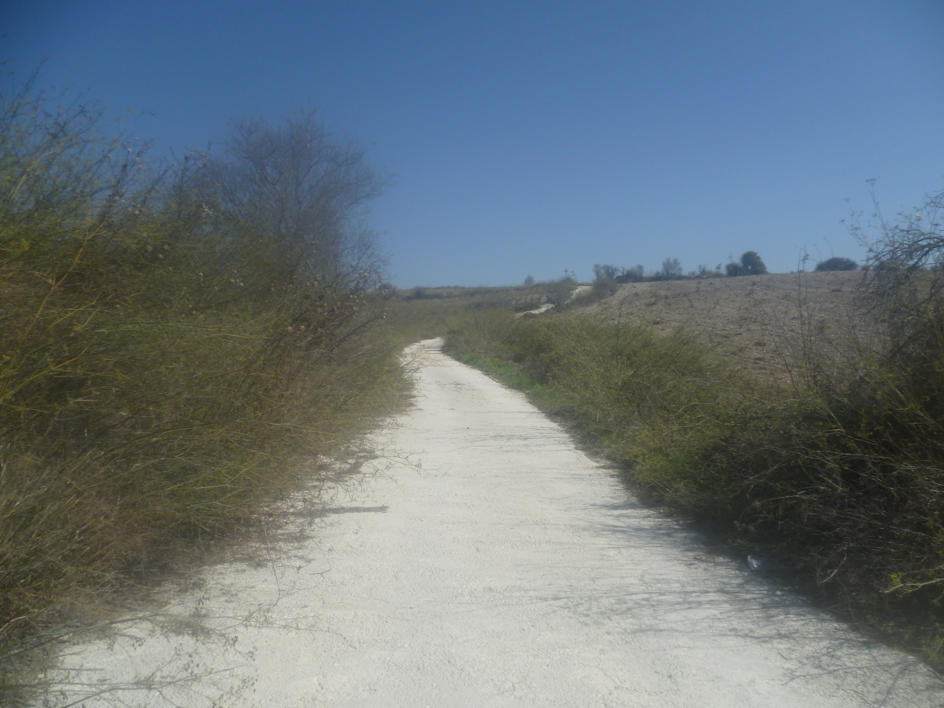
Cross the valley bed after about 7-8 minutes and your path will soon start to ascend the other side of the valley in the shadow of the cliffs. This is the potentially problematical mud path mentioned at the start but, as you can see from the picture below, this hasn’t been a particular problem whenever we’ve walked it.
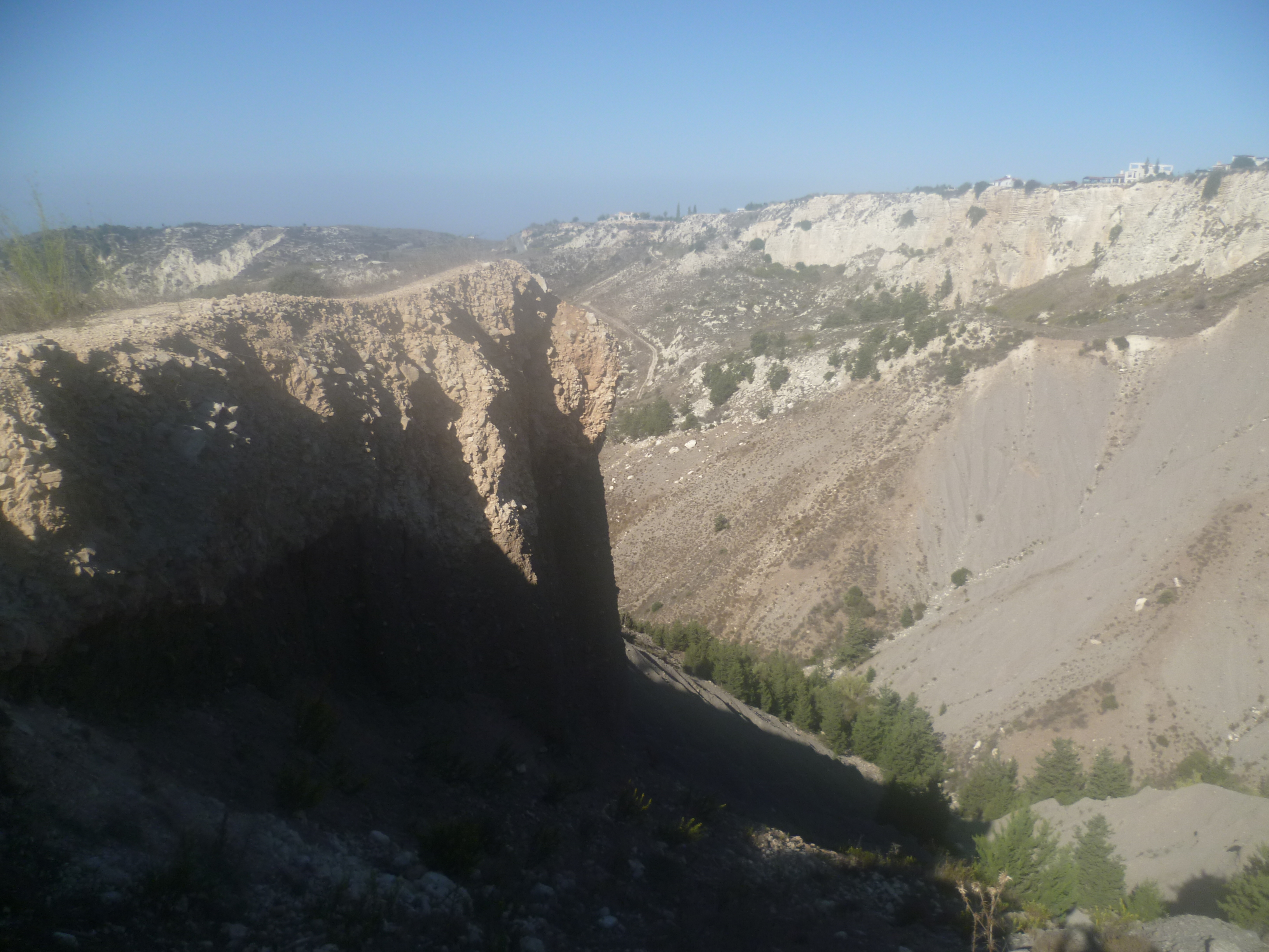
It isn’t a very long climb and you can look back across the valley to see – and definitely hear! – donkeys braying at you. After a further seven or eight minutes you will reach a precipitous cliff edge (40 minutes)…
…walk carefully along here for a few metres then turn left onto a track.
You will soon reach another sign pointing back the way you have come. Opposite the sign you will see a path zig-zagging upwards to your left.
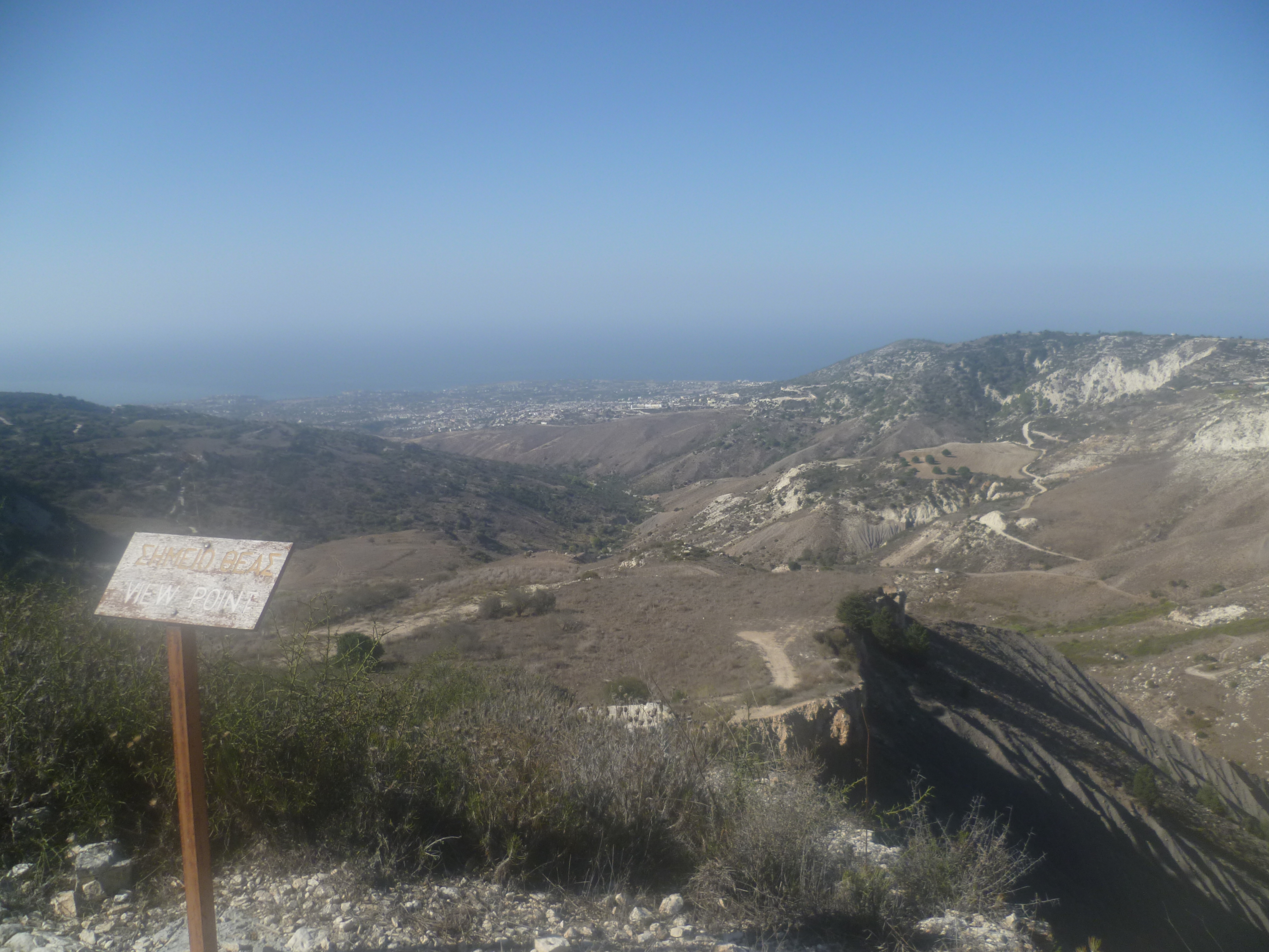
Follow this to reach a viewpoint with a bench (45 minutes). It’s worth a brief stop here to enjoy the views across to Pegia and Coral Bay. You can see the wreck of the Edro III, a 2,517-ton freighter which ran ashore during stormy weather in December 2011 on its way to Rhodes. Not much treasure to be found as it was carrying an unexciting cargo of plasterboard.
Continue up along the dirt track for a further few metres until it reaches a concrete road. Turn left here and head past a building with a chain-link fence on your right then alongside vineyards until you arrive at a crossroads (55 minutes).
If you wish to return at this point it’s a simple process to turn left here. Within a few minutes the road will take you back downhill to the start of the Agiasmata Nature Trail and, from there, you can stroll back into Kathikas. This abbreviated walk should see you back at a decent village café within about an hour and 20 minutes in total.
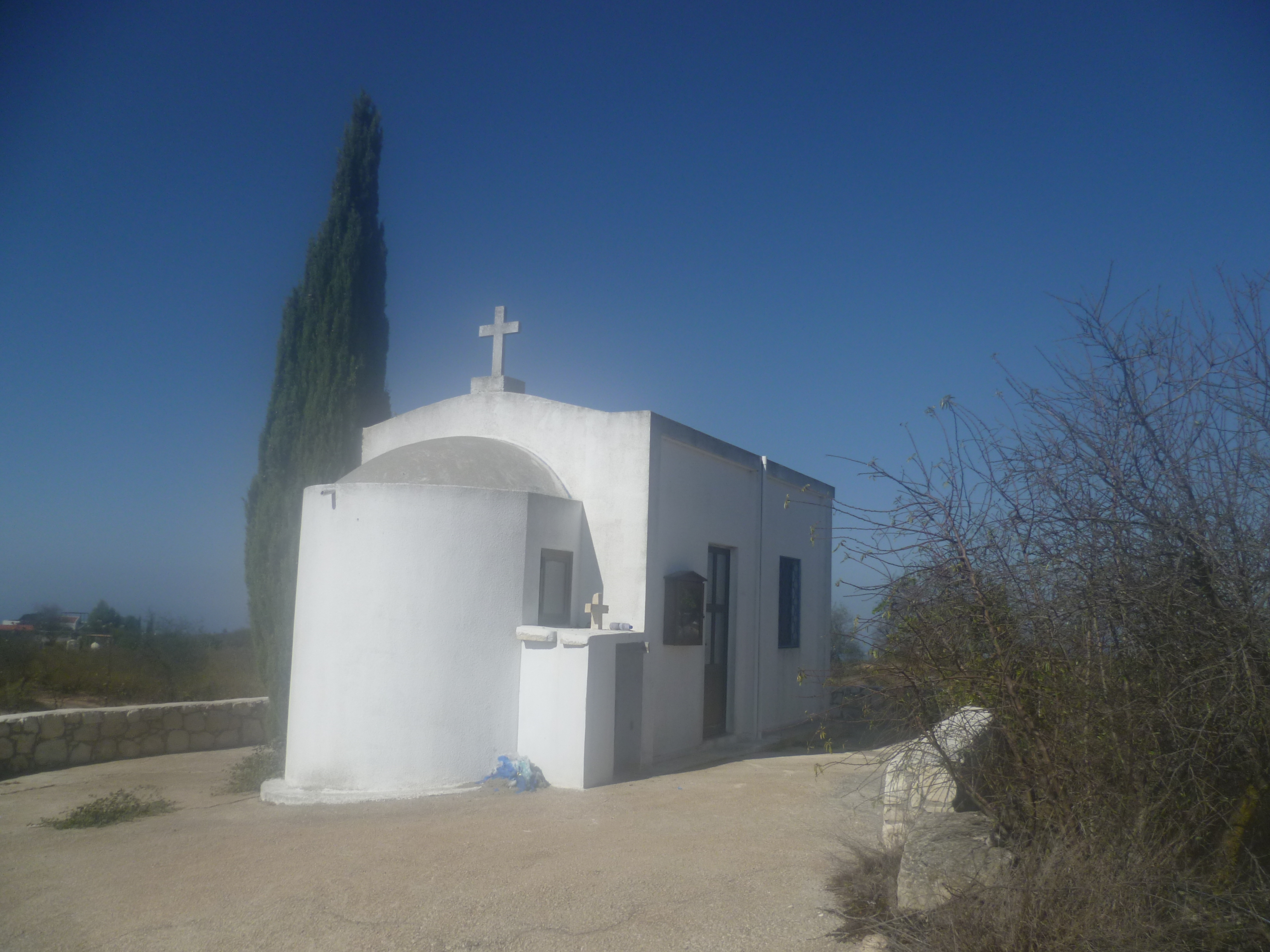
Otherwise your path now heads right at the crossroads towards – and past – the tiny church of Ayia Marina.
Passing the church on your right-hand side, continue more or less straight ahead. Ignore any tracks to the right or left until you reach a T-junction with a concrete road (1 hour 10 minutes). Turn left and walk towards a large house, passing it on your right before reaching the Akoursos road (1 hour 15 minutes).
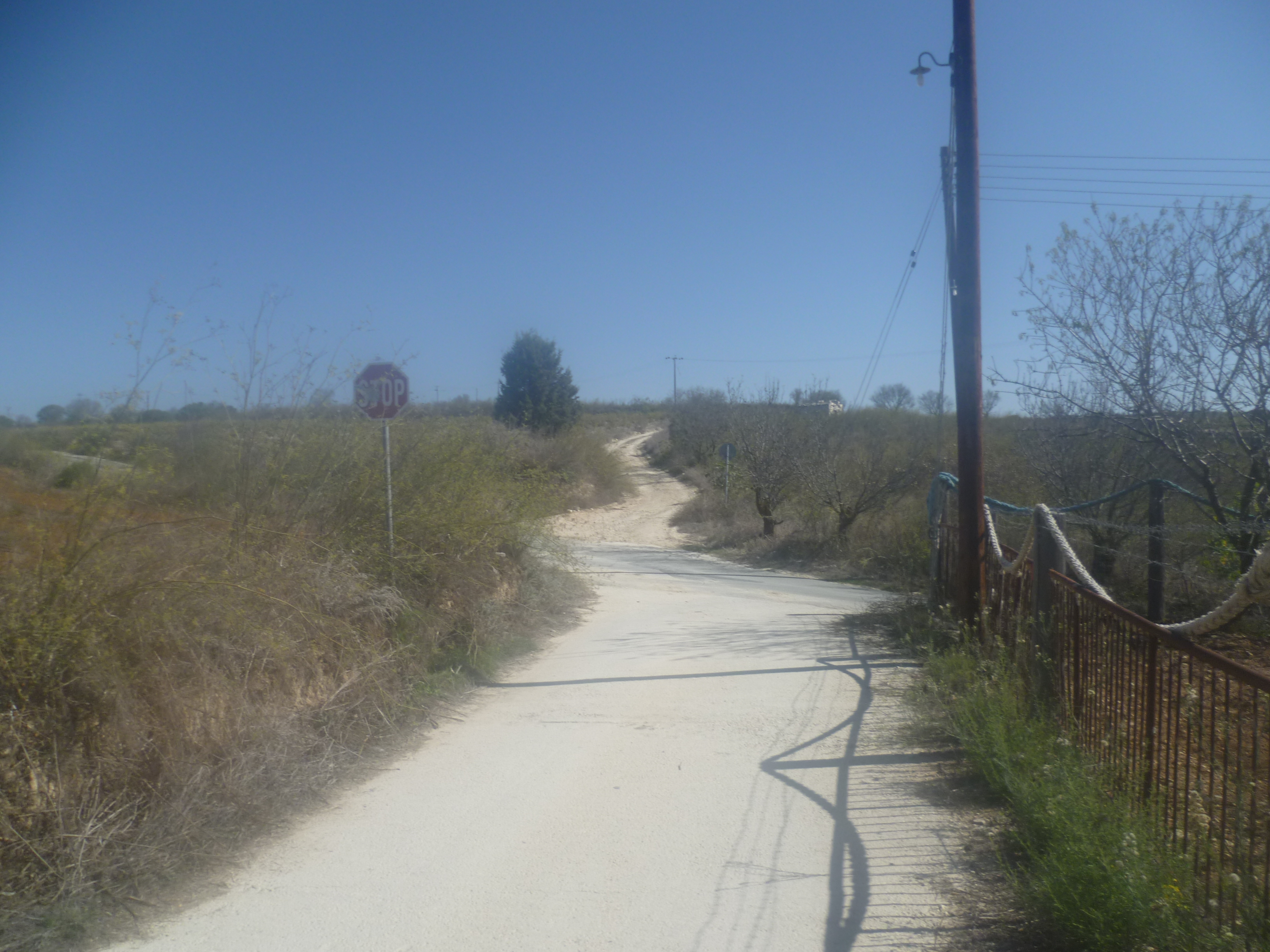
There is an opportunity to turn left at this point and walk this quiet asphalt road back into Kathikas. It’s approximately 1.5 km of comparatively easy walking and should take you about 20 minutes. You will arrive back in the village after about 1 hour 35 minutes.
If you wish to carry on there is a dirt track on the other side of the asphalt road. Head along this…
…going straight over a crossing track some 400 metres further on.

After a further 600 metres (approximately 1 hour 27 minutes) turn sharp left off the main track onto a fainter track along the edge of a vineyard. (This turning is easy to miss so keep your eyes peeled – it’s about 100 metres before a stronger track, also to the left, which passes in front of a small house.) As this is a key junction it may help to know that the relevant GPS reading is 34.898861, 32.437405.
After a couple of minutes’ walking go straight ahead at a crossroads then, after a further two minutes, go right at a Y-fork (34.900638, 32.435034) Keep straight ahead, ignoring a sharp turn to the right. About three minutes later take a left turn. Ignore any further tracks to both right and left until you reach a T-junction (1 hour 35 minutes) where you will turn right. After 200 metres turn left onto a clear track which soon bears left and leads you back to the Akoursos asphalt road at 1 hour 40 minutes. From here you will turn right and it is a simple short walk back into Kathikas where you will arrive at around 1 hour 50 minutes.
Birds seen on this walk: Chiffchaff, Chukar, Common Buzzard, Cyprus Warbler, Cyprus Wheatear, Great Tit, Hooded Crow, House Sparrow, Jackdaw, Kestrel, Long-legged Buzzard, Magpie, Pigeon, Rock Dove, Sardinian Warbler, Stonechat, Willow Warbler.

We tried this walk in March 2015 but were defeated by mud slides! However in November 2015 we tried again and found that the path had been reinstated and was fine.
Hi Simon – Yes, we saw your comments on the Sunflower site and were slightly wary when we did this walk in October! But, as you say, the path has since been reinstated – which is good because that section of the walk really is rather beautiful. For us, the real problem came at the 1hr 27 mins point where we took a wrong turning and ended up wandering around a maze of country paths! We’ve put a cautionary comment on both of these potential issues in the new (7th) edition of the Sunflower guide. Best wishes – Mark
Hi, I tried this walk in April but somehow started it back to front! I realised this after a few km and just retraced my steps but even once I was back to the beginning I couldn’t find the correct starting point. If you ever re do this walk, I would love to join you to find the correct route! Thanks.
Hi Vicky! Sorry this walk turned into a bit of a trial…I know from experience that it’s REALLY annoying when you can’t find the starting point. We’re currently revamping the walks with GPS coordinates to try and make it a bit more straightforward. This is a long job but if we get to Kathikas soon (we’re in Cyprus at the moment) then I’ll let you know! Mark
My wife and I have just returned from doing this walk ( Walk 12 in the Sunflower book)..We found the rocky path descent to the trail in spite of the absence of any trail sign. However, the descent into the valley was overgrown and the subsequent path up the cliff face looked muddy so we cut our losses and walked on almost to the Ag Marina church where there is a right turn and a trail arrow..We followed this reverse direction of the walk as far as the seat at the top of the cliff.. This is the 45 minute point in the walk. Having looked over the edge of the cliff at the zigzag path down we retraced our steps to Ag Marina and followed the directions from there. As others have pointed out, the sharp left hand track edging a vineyard is hard to identify (point 7).. We thought we had found it but the track we were following took us into the rows of vines. We turned back and continued along the main track for some time until we encountered a concrete track to the left alongside another vineyard..We followed this diligently, taking the right hand path at an obvious junction. The concrete reverted to trails and back to concrete until eventually we took a sweeping left turn up to the Akoursos road that we could see above us. A right turn brought us back to the car park in Kathikas in about 10 minutes. We suspect because of timings this junction was not far from the junction in the book but from a further circuit and may be the same one. The description at point 7 in the Sunflower book certainly needs further clarification.