Date Last Walked: April 2025
Distance: Approximately 11 miles (17 km)
Duration: Approximately 4 hours 25 minutes (excluding stops)
Difficulty: Relatively easy. Undulating contour walking with limited amounts of shade.
This is a reasonably easy circular walk along earth tracks and designated nature trails which takes in the finest Byzantine church on the island. Although the walking itself is little more than half a day, you will probably need to allow some time to look around the church itself, particularly if there are a number of tourist coach parties around.
The walk starts from the small village of Agios Theodoros just off the B9 to the north east of Kakopetria. Drive up the B9 beyond Evrychou and then take the F975 into the village. On the way into the village – just past a right hand bend after the village sign – there is a Forestry Department car park where you can leave your car. [GPS: 35.047155N, 32.929595E]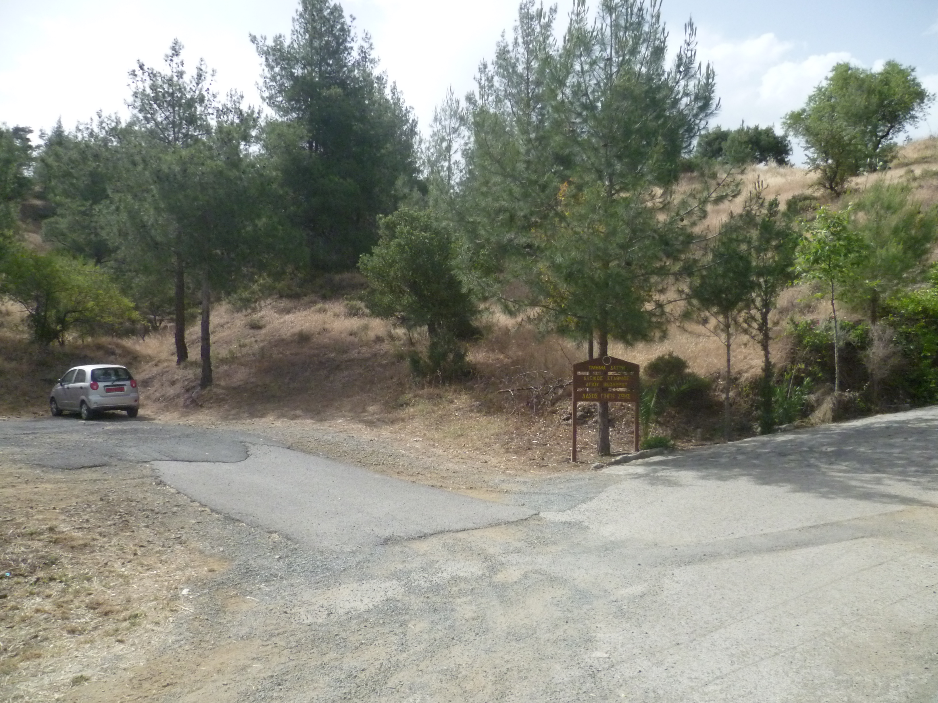
Turn right out of the car park, walking a few yards back down the road until you come to Agias Markellas Street. Turn right here and walk down this road. This is a very quiet asphalt road which winds upwards through pine trees.
After 10 minutes you will pass a wooden sign on your right identifying the location as Kantzelia, at an altitude of 491 metres. Keep following the road ignoring a right hand fork.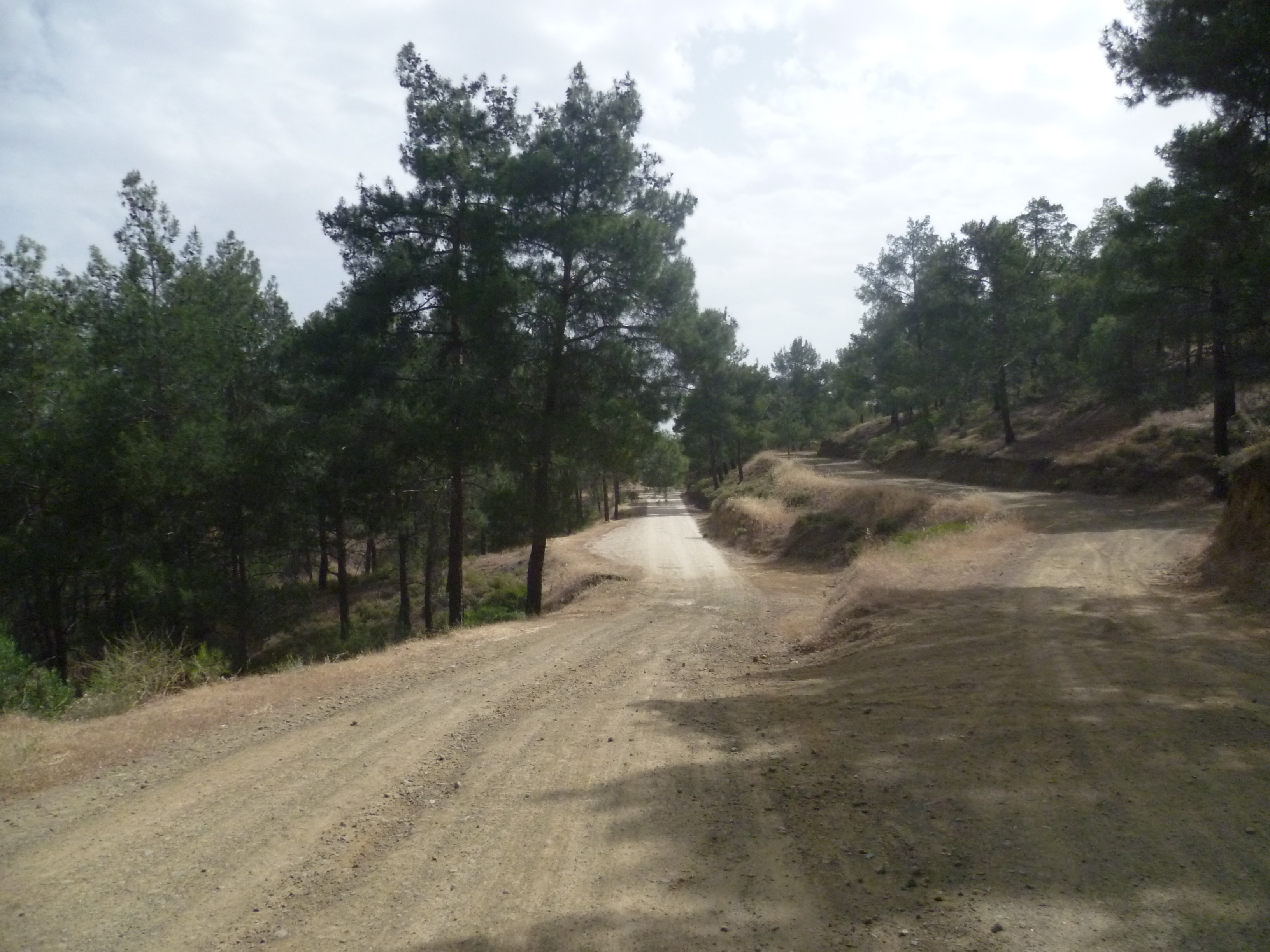
So, in the picture above, keep walking ahead through pine woods, gradually starting to descend. Just when you’re beginning to wonder if this empty road is really heading in the right direction you will see – at 22 minutes – a blue sign pointing out a track to your right headed for Asinou. [GPS: 35.057299N, 32.937368E]
Take this right hand turning and keep following a main earth road. You will not need to deviate from this wide track for the next couple of hours until you reach the Asinou Picnic Site (see below).
At 27 minutes you will pass a solitary house on a right hand bend in the track [GPS: 35.058373N, 32.940796E] and at 30 minutes you will come to a wide fork where, just to the right, a wooden sign identifies the area as Chalkokolympos, altitude 420m . Stay on the main track as it bends round to the left.

The track opens out to provide good views across to the north of the island and you are now effectively following a contour trail around the edges of a pine forest. The track is undulating: largely level at first and even with some downhill stretches but becoming gradually steeper. This is not a particular problem but it should be borne in mind that there is very little shade and the walk can be quite sapping on hot and/or humid days.
There are plenty of opportunities to enjoy some panoramic views to your left and to identify bird life in this comparatively remote area. There are no signposts on this section so you will need to stick doggedly to the main earth track which is, fortunately, extremely clear. White stone trig points at irregular intervals will give you confidence that you are on the right track. You will pass an electricity sub-station at around 1 hour 45 minutes…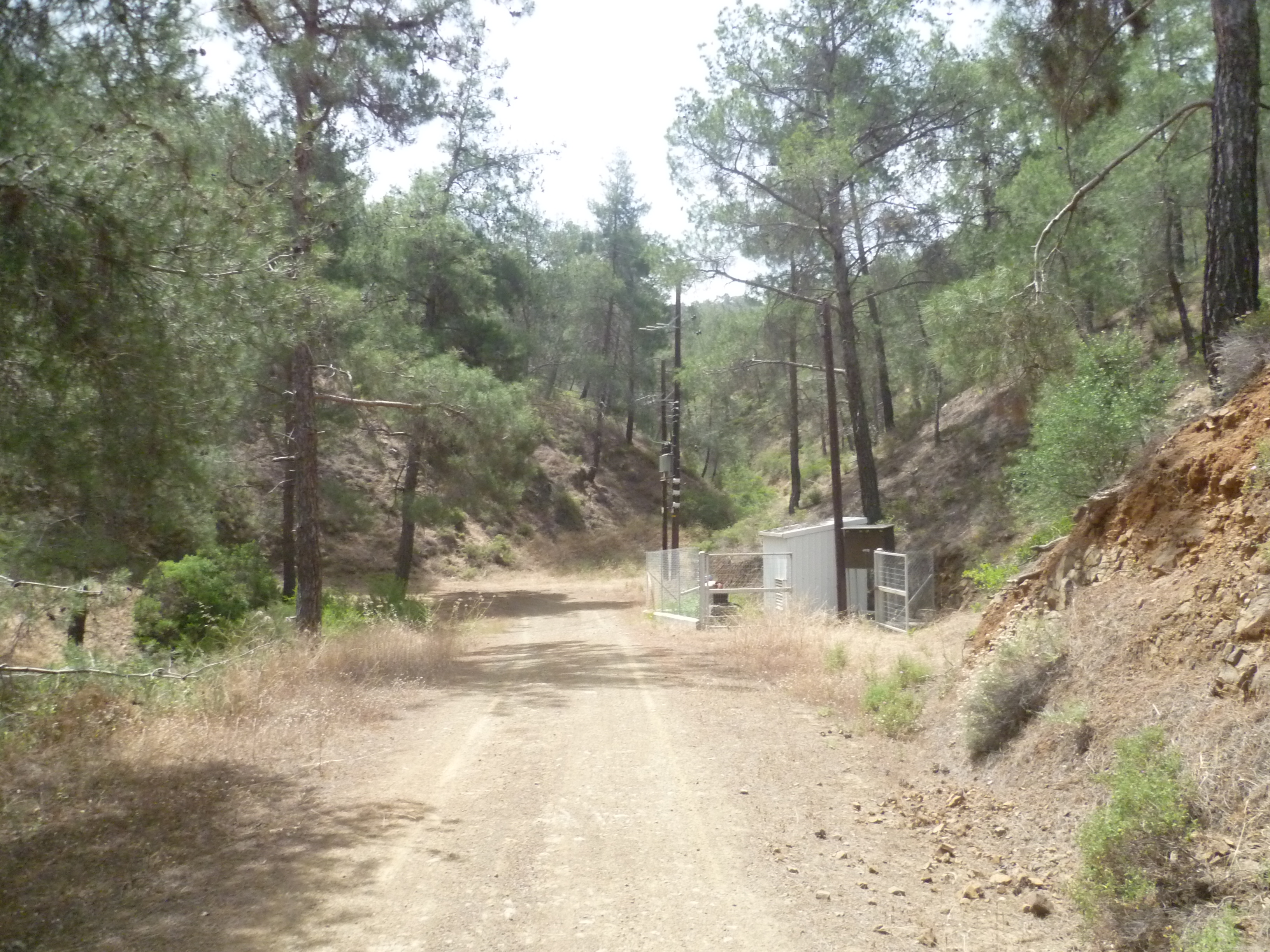
…and another solitary house, built from a cargo container [GPS: 35.067783N, 32.968900E], at 1 hour 50 minutes.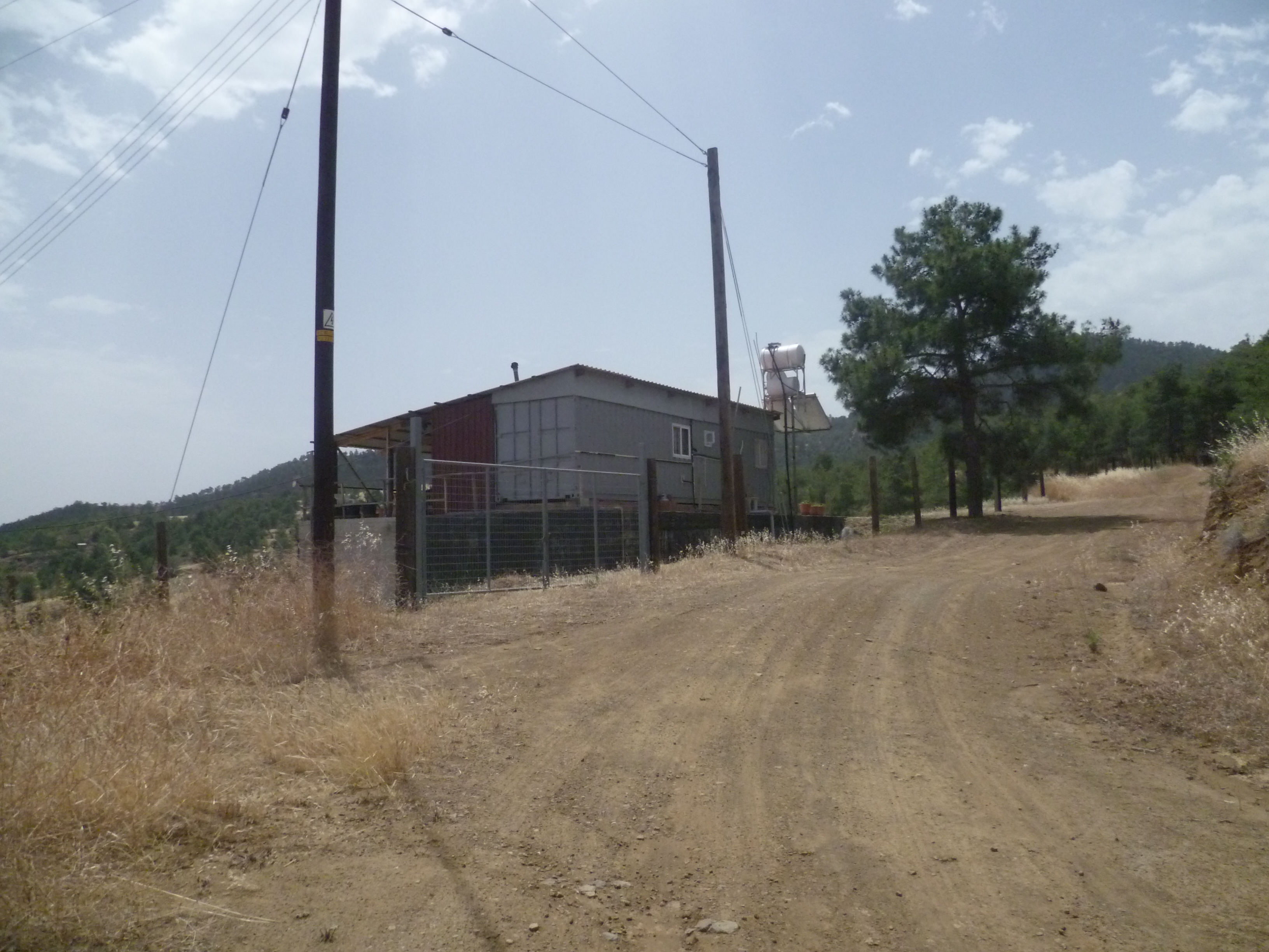
At around 2 hours 20 minutes you will see the village of Nikitari appear below to the left of the track and approximately 15 minutes later the track will gradually wind down towards the Asinou Picnic Site [GPS: 35.055881N, 32.982689E] (2 hours 40 minutes).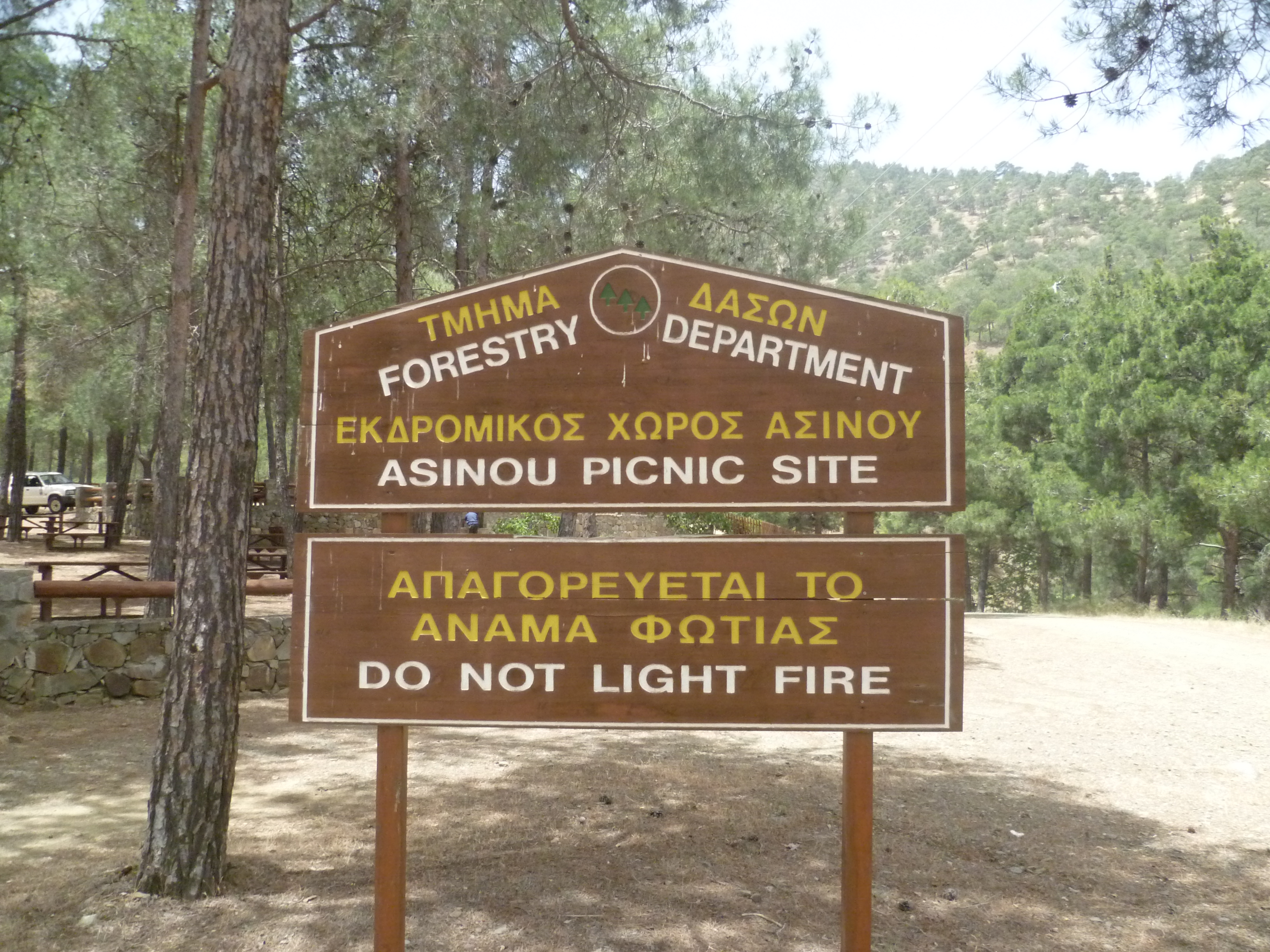
There is an opportunity to refill water bottles from a tap here where the water is fresh and deliciously cold. There are also toilets and plenty of picnic tables and benches.
When you are ready to carry on, there is still a little way to go to Asinou itself. Walk uphill along the asphalt road from the picnic site. It isn’t busy as it effectively ends at Asinou but, depending on the season, there may be the odd tour bus or two.
Walk up the road for the next 15-20 minutes until you arrive at the church of Panagia Phorbiotissa at Asinou [GPS: 35.046020N, 32.973487E] (3 hours)
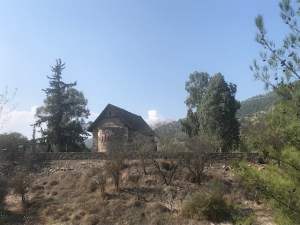
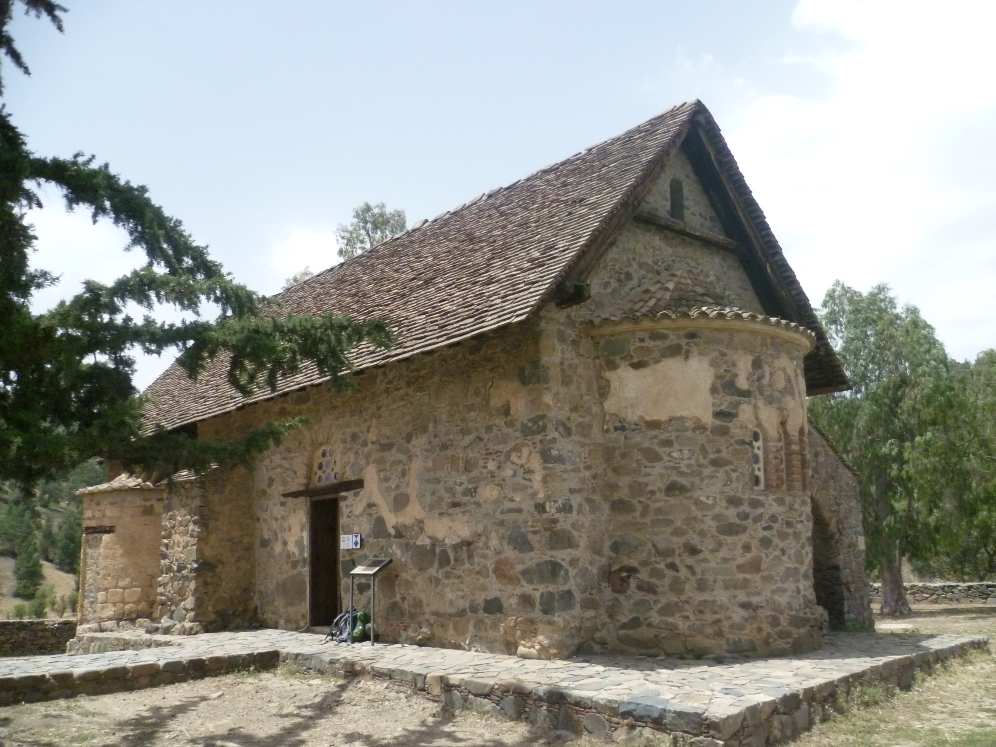
We first visited this church over 15 years ago on a misty day in late October and, apart from the custodian, we had it to ourselves. These days – depending on the time of year -we are often joined by a steady stream of tourist coaches visiting the church and having lunch at the nearby restaurants. Early and late in the calendar year, though, there is still a good opportunity to view the church in peace and quiet.
The church is a popular tourist site for good reason. Every inch of the shadowy interior (take a torch – no photos allowed) is covered with Byzantine murals painted between the early 11th and late 15th centuries and depicting Biblical scenes as well as portraits of various donors who paid for the church and its murals. We particularly like the bust of the Virgin Mary painted above one of the doorways, with a pair of tethered hounds and two mouflons against a background of snowy mountains. The scenes from the Last Judgement are spectacularly gruesome!
There’s a water tap outside but on hot days the water is warm enough for a hot bath! Much better to visit one of the cafes and buy an ice cold drink. Or two.
When you are ready to return to Agios Theodoros you will need to find the marked walking trail which takes you back through the pine forest. It is marked up as the ‘Forest Trail Asinou-Agios Theodoros’ and is identified on the trailboard in front of the church.
Turn right as you leave the church and continue along the road that you arrived on. Almost immediately you will see a signboard on your right…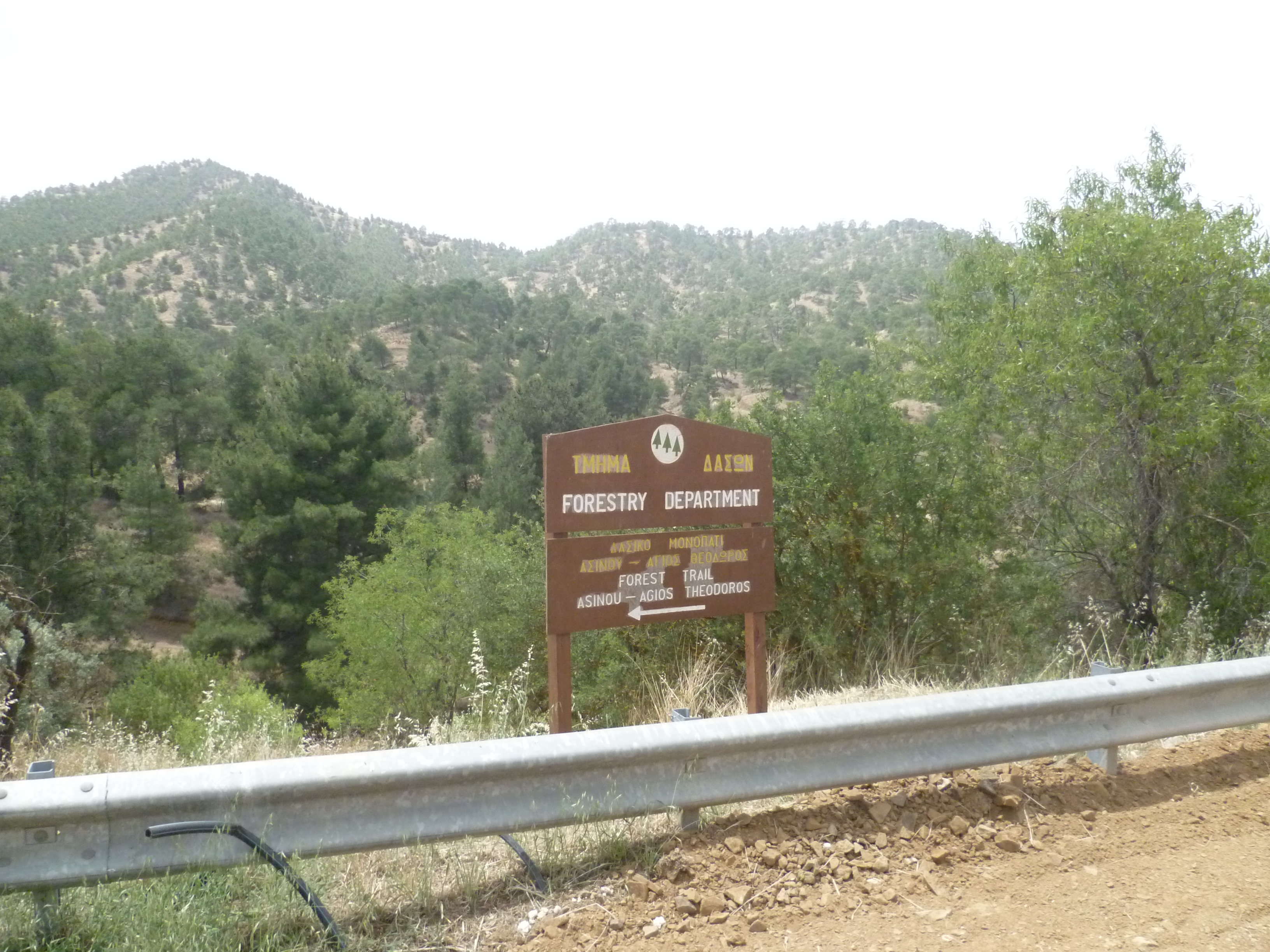
…and within a couple of minutes come to a large restaurant. Keep following the road as it heads past the restaurant and loops to the right, with a car park area on your left. Also on your left you will see a small trail sign with the legend “Forest Trail”…
… and then behind the restaurant keep following the road as it heads past the restaurant and out into the countryside.
This is your walking track back to Agios Theodoros.
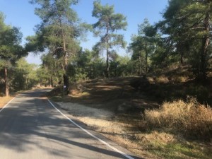
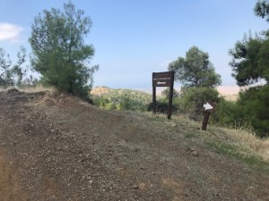
There is a trail sign and bench marking the area of Kandakia after about 15 minutes [GPS: 35.041439N, 32.964227E] (3 hours 10 minutes).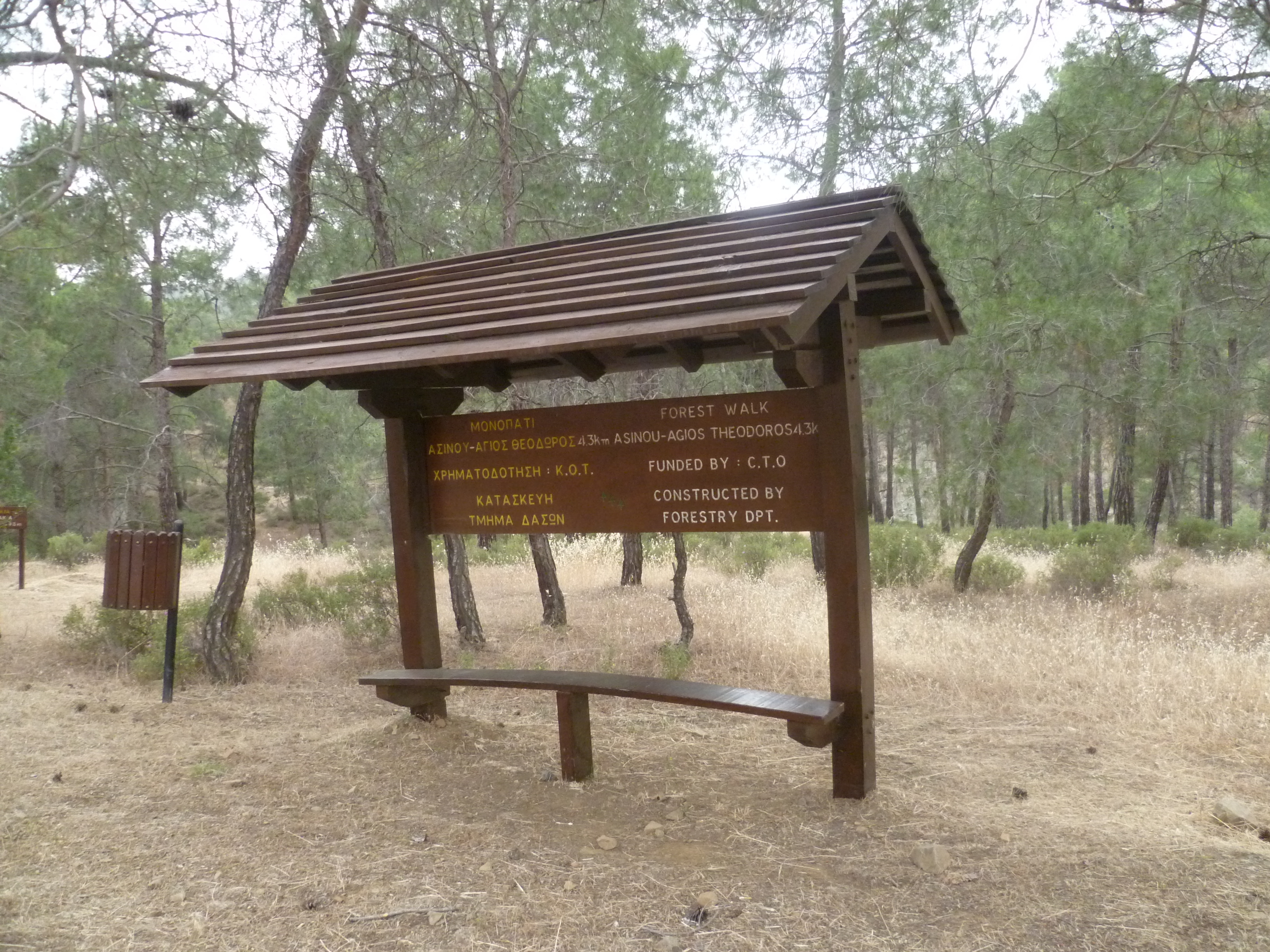
Turn off to the right here onto the signed nature trail to Agios Theodoros, as indicated in the photo above.
From this point onwards the path is very well marked and you should have little difficulty following it through the woods. The trail is marked by small wooden boards with white arrows on them and if you keep these in mind you shouldn’t go wrong.
The trail is through beautiful pine woodland with some quite steep uphill sections. The high point is reached after 3 hours 45 minutes when a final brief but steep climb brings you to Selladi Zevxis at an altitude of 652 metres.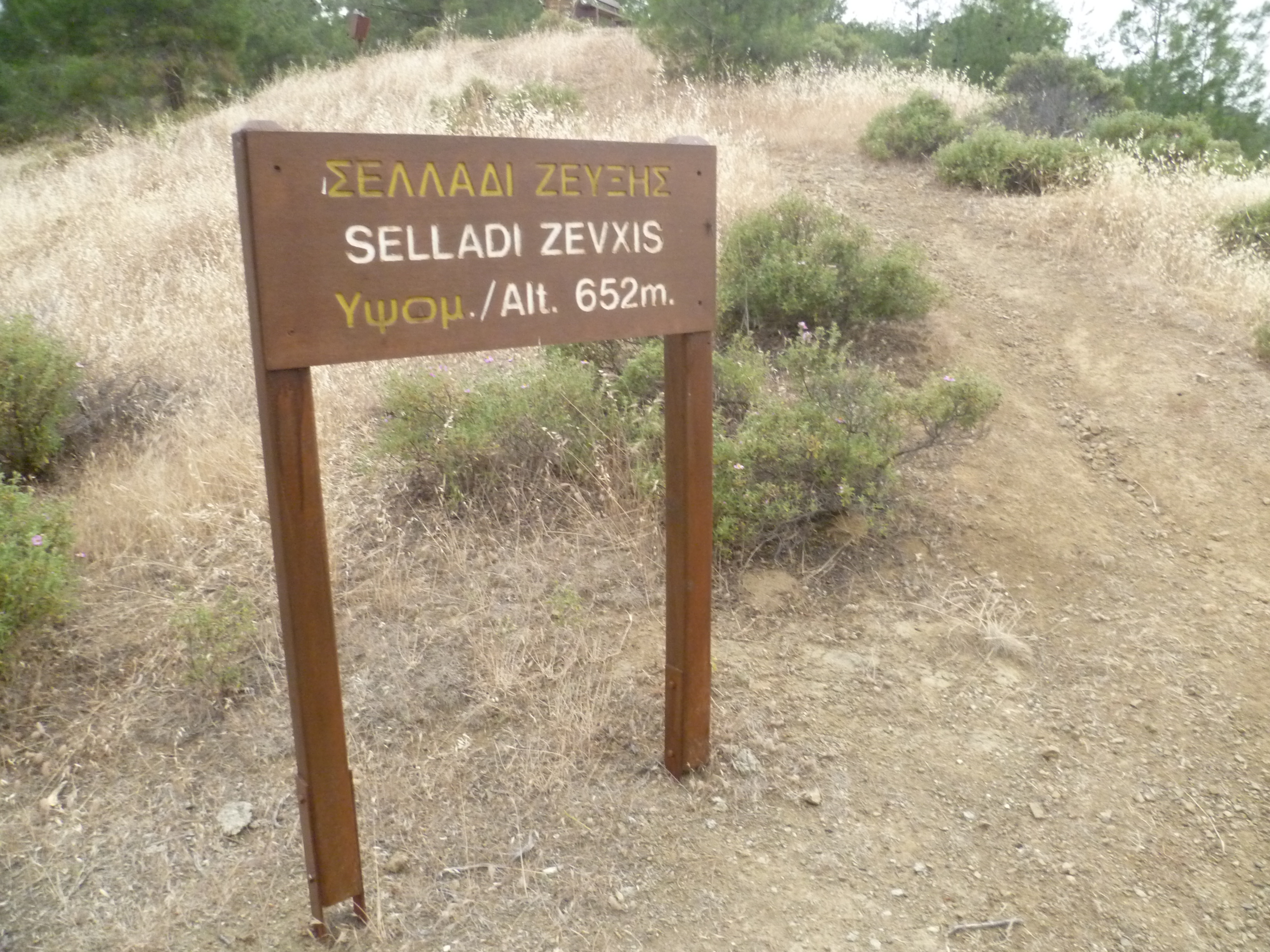
The trail opens out onto a ridge where there is a bench and a viewing point to take in the beautiful surroundings.
From now on you are once again walking the contours, descending gradually, and looking out across wide open valleys onto the distant northern plains.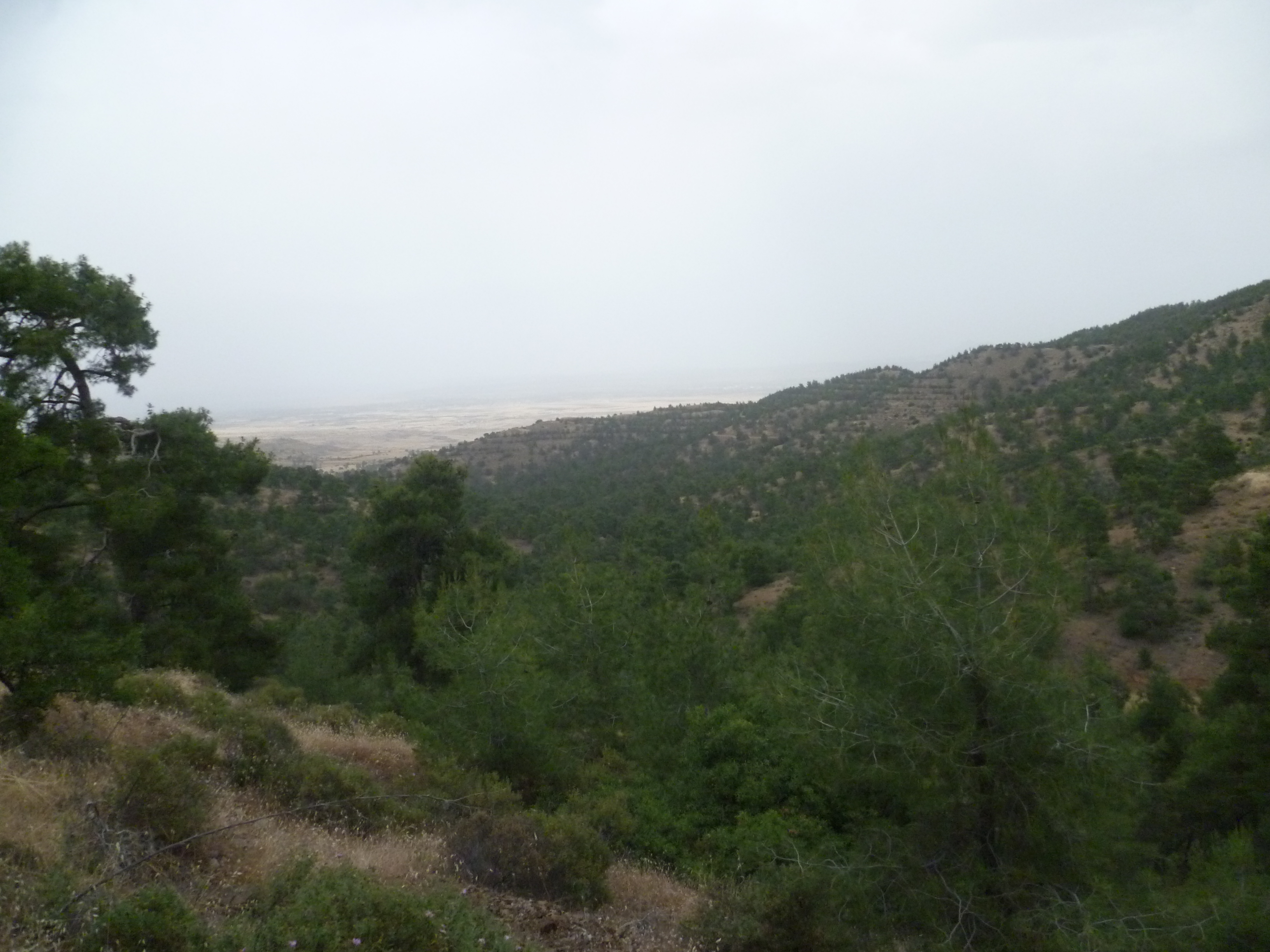
At around 3 hours 50 minutes you will emerge onto an earth road. Turn left uphill and, within 100 metres, turn right downhill following signed steps. [GPS: 35.041866N, 32.946310E]
Keep following the trail as it descends towards Agios Theodoros, passing the village cemetery on your left [GPS: 35.044585N, 32.934035E] (4 hours 15 minutes) and shortly afterwards arriving out on the F975 asphalt road which passes through the village. There is a trail board here on your right as you emerge onto the road at 4 hours 20 minutes.
Turn right onto the quiet F975 and walk for a few brief minutes to return to the Forestry Department car park after 4 hours 25 minutes.
Birds seen on this walk: Barn Swallow ,Chaffinch, Coal Tit, Cretschmar’s Bunting, Cyprus Wheatear, Great Tit, Goldfinch, Greenfinch, Hoopoe, House Sparrow, Jay, Linnet, Masked Shrike, Peregrine Falcon
